Łęczyca night lights from space
Night Light of Łęczyca (Łódź Voivodeship) from space (Poland) Src. Average luminocity for 10x10km area is 5.4419% and for 50x50km: 4.2862%.
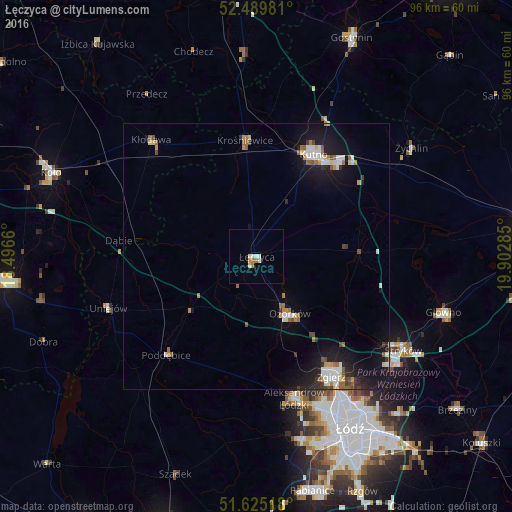
Analysis of Łęczyca night lights 2016
Square area 10x10 km:
 1.01%
1.01%90-99
1.39%80-89
0.63%70-79
0.51%60-69
1.52%50-59
0%40-49
0%30-39
0%20-29
0%10-19
0%0-9
94.95%Square area 50x50 km:
0.66%90-99
0.77%80-89
0.31%70-79
0.39%60-69
0.56%50-59
0.56%40-49
0.41%30-39
0.35%20-29
0.74%10-19
4.31%0-9
90.93%Clear (daylight) street map image can be seen on geolist.org.
Map coordinates:
52° 29' 23.3" North, 18° 29' 47.8" East
52° 3' 34.5" North, 19° 11' 59" East
51° 37' 30.6" North, 19° 54' 10.3" East
Some cities around Łęczyca sort by population:
• Zgierz
26.7 km =16.6 mi,  148°
148°
• Kutno
22.1 km =13.7 mi,  30°
30°
• Ozorków
12.4 km =7.7 mi, 149°
• Aleksandrów Łódzki
27.6 km =17.1 mi,  165°
165°
• Konstantynów Łódzki
35.7 km =22.2 mi, 166°
• Żychlin
35.6 km =22.1 mi,  54°
54°
• Poddębice
24.8 km =15.4 mi,  221°
221°
• Kłodawa
29.2 km =18.1 mi,  317°
317°
3093726 (p: 15,528)
Sources (retrieved 2019-11-25):
» Earth at Night: Flat Maps 2012, 2016