Środa Wielkopolska night lights from space
Night Light of Środa Wielkopolska (Greater Poland) from space (Poland) Src. Average luminocity for 10x10km area is 11.8651% and for 50x50km: 9.929%.
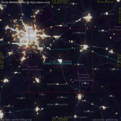
Analysis of Środa Wielkopolska night lights 2016
Square area 10x10 km:
 3.84%
3.84%90-99
3.57%80-89
0%70-79
0%60-69
0.53%50-59
1.06%40-49
0.53%30-39
0%20-29
0.53%10-19
3.97%0-9
85.98%Square area 50x50 km:
2.47%90-99
2.26%80-89
0.71%70-79
0.77%60-69
0.83%50-59
1.2%40-49
0.94%30-39
1.34%20-29
1.76%10-19
4.73%0-9
82.97%Clear (daylight) street map image can be seen on geolist.org.
Map coordinates:
52° 39' 25.3" North, 16° 34' 23" East
52° 13' 42.3" North, 17° 16' 34.2" East
51° 47' 44.4" North, 17° 58' 45.5" East
Some cities around Środa Wielkopolska sort by population:
• Śrem
23.6 km =14.7 mi,  228°
228°
• Swarzędz
24.3 km =15.1 mi,  327°
327°
• Września
22.4 km =13.9 mi,  61°
61°
• Luboń
29.2 km =18.1 mi,  296°
296°
• Mosina
29.3 km =18.2 mi,  273°
273°
• Kostrzyn
19.2 km =11.9 mi,  350°
350°
• Pobiedziska
27.7 km =17.2 mi,  1°
1°
• Kórnik
12.9 km =8 mi,  279°
279°
3085045 (p: 21,757)
Sources (retrieved 2019-11-25):
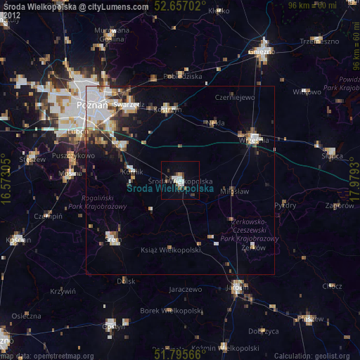
» Earth at Night: Flat Maps 2012, 2016