Swarzędz night lights from space
Night Light of Swarzędz (Greater Poland) from space (Poland) Src. Average luminocity for 10x10km area is 39.4116% and for 50x50km: 18.2333%.
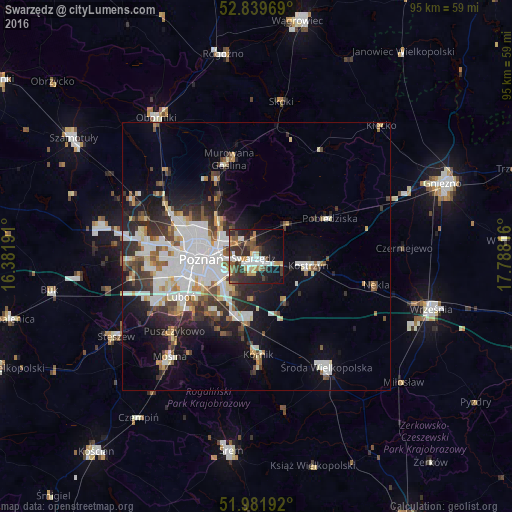
Analysis of Swarzędz night lights 2016
Square area 10x10 km:
 7.32%
7.32%90-99
5.81%80-89
2.15%70-79
6.57%60-69
3.79%50-59
7.07%40-49
5.05%30-39
12.63%20-29
12.25%10-19
22.6%0-9
14.77%Square area 50x50 km:
4.52%90-99
4.19%80-89
1.48%70-79
1.56%60-69
1.49%50-59
2.23%40-49
1.82%30-39
2.92%20-29
4.36%10-19
8.02%0-9
67.41%Clear (daylight) street map image can be seen on geolist.org.
Map coordinates:
52° 50' 22.9" North, 16° 22' 54.9" East
52° 24' 46.4" North, 17° 5' 6.1" East
51° 58' 54.9" North, 17° 47' 17.4" East
Some cities around Swarzędz sort by population:
• Poznań
10.5 km =6.5 mi,  266°
266°
• Luboń
15 km =9.3 mi,  240°
240°
• Murowana Goślina
18.7 km =11.6 mi,  344°
344°
• Kostrzyn
9.8 km =6.1 mi,  99°
99°
• Pobiedziska
15.5 km =9.6 mi,  62°
62°
• Kórnik
18.4 km =11.4 mi,  179°
179°
• Plewiska
19.4 km =12.1 mi,  254°
254°
• Czerwonak
9.1 km =5.7 mi,  309°
309°
3084130 (p: 29,010)
Sources (retrieved 2019-11-25):
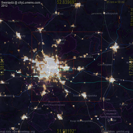
» Earth at Night: Flat Maps 2012, 2016