Luboń night lights from space
Night Light of Luboń (Greater Poland) from space (Poland) Src. Average luminocity for 10x10km area is 71.5884% and for 50x50km: 19.214%.
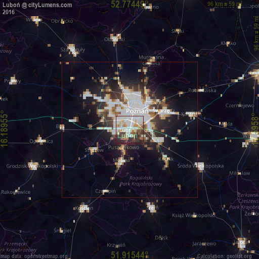
Analysis of Luboń night lights 2016
Square area 10x10 km:
 21.84%
90-99
22.1%80-89
7.95%70-79
6.69%60-69
5.68%50-59
6.44%40-49
6.57%30-39
9.47%20-29
11.99%10-19
1.26%0-9
0%Square area 50x50 km:
4.67%90-99
4.33%80-89
1.53%70-79
1.48%60-69
1.66%50-59
2.25%40-49
1.96%30-39
3.18%20-29
4.58%10-19
9.41%0-9
64.95%Clear (daylight) street map image can be seen on geolist.org.
Map coordinates:
52° 46' 28.2" North, 16° 11' 22.4" East
52° 20' 49.4" North, 16° 53' 33.6" East
51° 54' 55.6" North, 17° 35' 44.9" East
Some cities around Luboń sort by population:
• Poznań
7.1 km =4.4 mi,  20°
20°
• Swarzędz
15 km =9.3 mi,  60°
60°
• Mosina
11.7 km =7.3 mi,  195°
195°
• Puszczykowo
7.4 km =4.6 mi, 203°
• Plewiska
6 km =3.7 mi,  291°
291°
• Stęszew
14.8 km =9.2 mi,  241°
241°
• Czerwonak
14.4 km =8.9 mi, 24°
• Komorniki
5.6 km =3.5 mi,  260°
260°
3092856 (p: 26,431)
Sources (retrieved 2019-11-25):
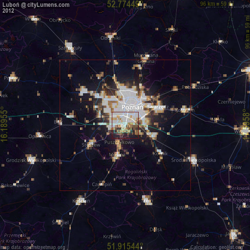
» Earth at Night: Flat Maps 2012, 2016