Pobiedziska night lights from space
Night Light of Pobiedziska (Greater Poland) from space (Poland) Src. Average luminocity for 10x10km area is 3.202% and for 50x50km: 11.4169%.
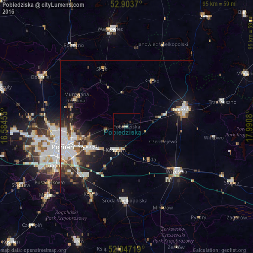
Analysis of Pobiedziska night lights 2016
Square area 10x10 km:
 0.25%
0.25%90-99
1.14%80-89
0.13%70-79
0%60-69
0%50-59
0.51%40-49
0%30-39
0.51%20-29
1.64%10-19
0.38%0-9
95.45%Square area 50x50 km:
2.48%90-99
2.44%80-89
0.89%70-79
1.04%60-69
1.05%50-59
1.42%40-49
1.22%30-39
1.63%20-29
2.36%10-19
7.11%0-9
78.37%Clear (daylight) street map image can be seen on geolist.org.
Map coordinates:
52° 54' 13.3" North, 16° 35' 4.4" East
52° 28' 39.1" North, 17° 17' 15.6" East
52° 2' 49.9" North, 17° 59' 26.9" East
Some cities around Pobiedziska sort by population:
• Poznań
25.5 km =15.8 mi,  252°
252°
• Gniezno
21 km =13 mi,  72°
72°
• Swarzędz
15.5 km =9.6 mi,  242°
242°
• Września
25.3 km =15.7 mi,  131°
131°
• Środa Wielkopolska
27.7 km =17.2 mi,  181°
181°
• Murowana Goślina
21.7 km =13.5 mi,  299°
299°
• Kostrzyn
9.7 km =6 mi,  204°
204°
• Czerwonak
20.8 km =12.9 mi,  266°
266°
3088749 (p: 8,677)
Sources (retrieved 2019-11-25):
» Earth at Night: Flat Maps 2012, 2016