Ludwin night lights from space
Night Light of Ludwin (Lublin) from space (Poland) Src. Average luminocity for 10x10km area is 4.381% and for 50x50km: 6.4957%.
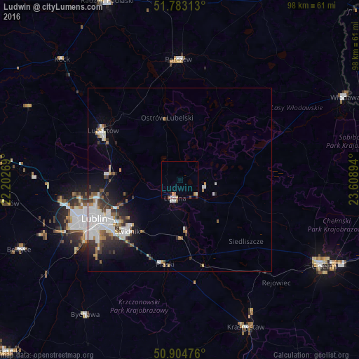
Analysis of Ludwin night lights 2016
Square area 10x10 km:
 0.56%
0.56%90-99
0.84%80-89
0.28%70-79
1.12%60-69
0.28%50-59
0.7%40-49
0.14%30-39
0.28%20-29
0.56%10-19
0%0-9
95.24%Square area 50x50 km:
1.81%90-99
1.43%80-89
0.37%70-79
0.51%60-69
0.5%50-59
0.66%40-49
0.67%30-39
0.98%20-29
1.47%10-19
2.66%0-9
88.92%Clear (daylight) street map image can be seen on geolist.org.
Map coordinates:
51° 46' 59.3" North, 22° 12' 9.7" East
51° 20' 45.8" North, 22° 54' 20.9" East
50° 54' 17.1" North, 23° 36' 32.2" East
Some cities around Ludwin sort by population:
• Lublin
25.9 km =16.1 mi,  245°
245°
• Chełm
45.4 km =28.2 mi,  119°
119°
• Świdnik
20.3 km =12.6 mi,  225°
225°
• Lubartów
24.2 km =15 mi,  301°
301°
• Łęczna
5.3 km =3.3 mi,  198°
198°
• Krasnystaw
44.3 km =27.5 mi,  155°
155°
• Parczew
32.7 km =20.3 mi,  359°
359°
• Bychawa
45 km =28 mi,  215°
215°
765804 (p: 5,041)
Sources (retrieved 2019-11-25):
» Earth at Night: Flat Maps 2012, 2016