Chełm night lights from space
Night Light of Chełm (Lublin) from space (Poland) Src. Average luminocity for 10x10km area is 23.0481% and for 50x50km: 1.5682%.
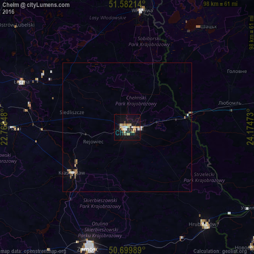
Analysis of Chełm night lights 2016
Square area 10x10 km:
 2.01%
2.01%90-99
2.14%80-89
6.95%70-79
4.41%60-69
1.2%50-59
1.87%40-49
1.74%30-39
0%20-29
6.02%10-19
24.87%0-9
48.8%Square area 50x50 km:
0.14%90-99
0.15%80-89
0.34%70-79
0.19%60-69
0.26%50-59
0.16%40-49
0.15%30-39
0.05%20-29
0.32%10-19
1.11%0-9
97.11%Clear (daylight) street map image can be seen on geolist.org.
Map coordinates:
51° 34' 55.7" North, 22° 46' 6.5" East
51° 8' 35.2" North, 23° 28' 17.8" East
50° 41' 59.6" North, 24° 10' 29" East
Some cities around Chełm sort by population:
• Zamość
49.2 km =30.6 mi,  198°
198°
• Łęczna
44.7 km =27.8 mi,  293°
293°
• Krasnystaw
27.2 km =16.9 mi,  229°
229°
• Hrubieszów
47.8 km =29.7 mi,  141°
141°
• Włodawa
45.6 km =28.3 mi,  6°
6°
• Liuboml, UA
40.5 km =25.2 mi,  76°
76°
• Shats’k, UA
51.4 km =31.9 mi,  39°
39°
• Ludwin
45.4 km =28.2 mi,  299°
299°
774558 (p: 68,043)
Sources (retrieved 2019-11-25):
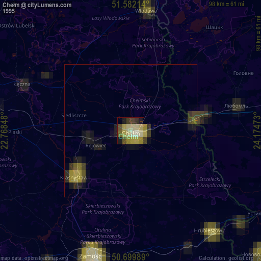
» NASA, Earths city lights 1995
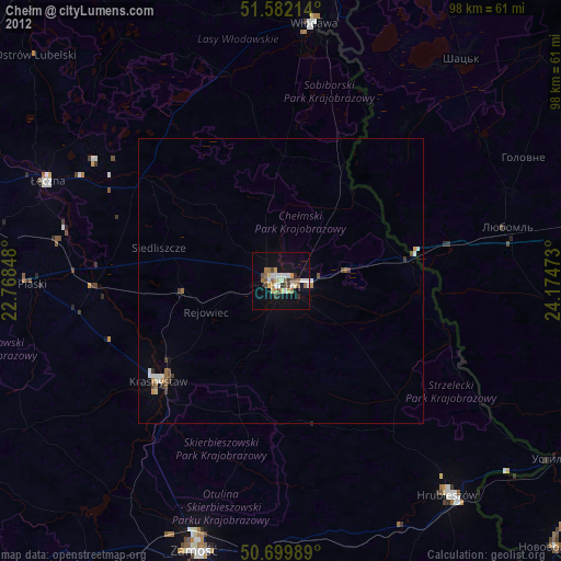
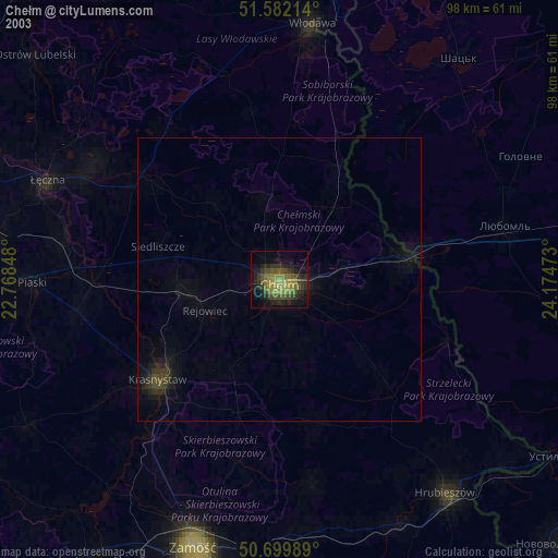
» NASA city lights 2003
» Earth at Night: Flat Maps 2012, 2016