Lubań night lights from space
Night Light of Lubań (Lower Silesia) from space (Poland) Src. Average luminocity for 10x10km area is 8.2674% and for 50x50km: 4.6993%.
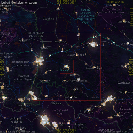

Analysis of Lubań night lights 2016
Square area 10x10 km:
 1.47%
1.47%90-99
1.2%80-89
1.07%70-79
1.34%60-69
0.8%50-59
0.8%40-49
1.34%30-39
0%20-29
0%10-19
0.53%0-9
91.44%Square area 50x50 km:
0.83%90-99
0.94%80-89
0.3%70-79
0.49%60-69
0.45%50-59
0.54%40-49
0.59%30-39
0.53%20-29
0.53%10-19
3.61%0-9
91.18%Clear (daylight) street map image can be seen on geolist.org.
Map coordinates:
51° 33' 33.8" North, 14° 35' 4.4" East
51° 7' 12.5" North, 15° 17' 15.6" East
50° 40' 36.1" North, 15° 59' 26.9" East
Some cities around Lubań sort by population:
• Görlitz, DE
21.2 km =13.2 mi,  280°
280°
• Bolesławiec
25.4 km =15.8 mi,  50°
50°
• Zgorzelec
19.8 km =12.3 mi, 279°
• Lwówek Śląski
20.8 km =12.9 mi,  92°
92°
• Frýdlant, CZ
26.5 km =16.5 mi,  213°
213°
• Gryfów Śląski
13.6 km =8.5 mi,  137°
137°
• Rothenburg, DE
32.5 km =20.2 mi,  316°
316°
• Pieńsk
22.1 km =13.7 mi,  310°
310°
3093040 (p: 22,245)
Sources (retrieved 2019-11-25):
» Earth at Night: Flat Maps 2012, 2016