Gryfów Śląski night lights from space
Night Light of Gryfów Śląski (Lower Silesia) from space (Poland) Src. Average luminocity for 10x10km area is 4.131% and for 50x50km: 3.295%.
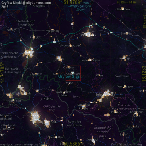
Analysis of Gryfów Śląski night lights 2016
Square area 10x10 km:
 0.94%
0.94%90-99
0.67%80-89
0.53%70-79
0.53%60-69
0.13%50-59
0.4%40-49
0.53%30-39
0.4%20-29
0.67%10-19
0.67%0-9
94.52%Square area 50x50 km:
0.5%90-99
0.55%80-89
0.33%70-79
0.38%60-69
0.33%50-59
0.32%40-49
0.44%30-39
0.34%20-29
0.27%10-19
2.47%0-9
94.07%Clear (daylight) street map image can be seen on geolist.org.
Map coordinates:
51° 28' 15.2" North, 14° 43' 1.4" East
51° 1' 50.9" North, 15° 25' 12.6" East
50° 35' 11.4" North, 16° 7' 23.9" East
Some cities around Gryfów Śląski sort by population:
• Jelenia Góra
26.1 km =16.2 mi,  123°
123°
• Bolesławiec
28 km =17.4 mi,  21°
21°
• Lubań
13.6 km =8.5 mi,  317°
317°
• Cieplice Śląskie Zdrój
26.1 km =16.2 mi,  134°
134°
• Lwówek Śląski
14.6 km =9.1 mi,  52°
52°
• Frýdlant, CZ
26.8 km =16.7 mi,  242°
242°
• Szklarska Poręba
23.9 km =14.9 mi,  162°
162°
• Piechowice
23.7 km =14.7 mi,  148°
148°
3098199 (p: 6,890)
Sources (retrieved 2019-11-25):
» Earth at Night: Flat Maps 2012, 2016