Frýdlant night lights from space
Night Light of Frýdlant (Liberecký kraj) from space (Czech Republic) Src. Average luminocity for 10x10km area is 3.1863% and for 50x50km: 6.1115%.
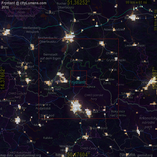
Analysis of Frýdlant night lights 2016
Square area 10x10 km:
 0.28%
0.28%90-99
0.84%80-89
0%70-79
0.56%60-69
0.42%50-59
0.14%40-49
1.12%30-39
0%20-29
0.56%10-19
0.56%0-9
95.52%Square area 50x50 km:
1.29%90-99
1.07%80-89
0.4%70-79
0.55%60-69
0.59%50-59
0.69%40-49
0.59%30-39
0.68%20-29
1.08%10-19
5.3%0-9
87.77%Clear (daylight) street map image can be seen on geolist.org.
Map coordinates:
51° 21' 45.1" North, 14° 22' 35.8" East
50° 55' 17" North, 15° 4' 47.1" East
50° 28' 33.7" North, 15° 46' 58.3" East
Some cities around Frýdlant sort by population:
• Liberec
17.2 km =10.7 mi,  185°
185°
• Jablonec nad Nisou
22.8 km =14.2 mi,  163°
163°
• Zgorzelec, PL
25.8 km =16 mi,  348°
348°
• Zittau, DE
19.3 km =12 mi,  262°
262°
• Bogatynia, PL
8.8 km =5.5 mi, 259°
• Hrádek nad Nisou
18.2 km =11.3 mi,  245°
245°
• Chrastava
14 km =8.7 mi,  213°
213°
• Olbersdorf, DE
22.4 km =13.9 mi, 256°
3076124 (p: 7,471)
Sources (retrieved 2019-11-25):
» Earth at Night: Flat Maps 2012, 2016