Kobyłka night lights from space
Night Light of Kobyłka (Mazovia) from space (Poland) Src. Average luminocity for 10x10km area is 46.9987% and for 50x50km: 32.7675%.
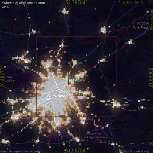
Analysis of Kobyłka night lights 2016
Square area 10x10 km:
100  6.06%
6.06%
90-99 9.22%
80-89 4.42%
70-79 8.08%
60-69 5.68%
50-59 6.69%
40-49 5.93%
30-39 8.71%
20-29 29.04%
10-19 16.16%
0-9 0%
6.06%90-99
9.22%80-89
4.42%70-79
8.08%60-69
5.68%50-59
6.69%40-49
5.93%30-39
8.71%20-29
29.04%10-19
16.16%0-9
0%Square area 50x50 km:
100 12.23%
90-99 7.26%
80-89 2.57%
70-79 3.05%
60-69 2.91%
50-59 2.9%
40-49 2.93%
30-39 3.25%
20-29 5.34%
10-19 8.2%
0-9 49.36%
12.23%90-99
7.26%80-89
2.57%70-79
3.05%60-69
2.91%50-59
2.9%40-49
2.93%30-39
3.25%20-29
5.34%10-19
8.2%0-9
49.36%Clear (daylight) street map image can be seen on geolist.org.
Map coordinates:
52° 46' 1.3" North, 20° 29' 34" East
52° 20' 22.3" North, 21° 11' 45.2" East
51° 54' 28.2" North, 21° 53' 56.5" East
Some cities around Kobyłka sort by population:
• Wołomin
3.1 km =1.9 mi,  88°
88°
• Ząbki
8.1 km =5 mi,  229°
229°
• Marki
6.5 km =4 mi,  251°
251°
• Rembertów
9 km =5.6 mi,  194°
194°
• Wesoła
9.6 km =6 mi,  168°
168°
• Sulejówek
10.9 km =6.8 mi,  152°
152°
• Zielonka
4.7 km =2.9 mi,  211°
211°
• Radzymin
8.5 km =5.3 mi,  354°
354°
768905 (p: 17,659)
Sources (retrieved 2019-11-25):
» Earth at Night: Flat Maps 2012, 2016