Ząbki night lights from space
Night Light of Ząbki (Mazovia) from space (Poland) Src. Average luminocity for 10x10km area is 86.5518% and for 50x50km: 39.9411%.
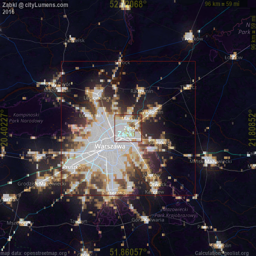
Analysis of Ząbki night lights 2016
Square area 10x10 km:
 42.55%
90-99
23.23%80-89
8.33%70-79
6.82%60-69
5.3%50-59
3.66%40-49
4.42%30-39
4.92%20-29
0.76%10-19
0%0-9
0%Square area 50x50 km:
13.72%90-99
8.76%80-89
3.41%70-79
3.64%60-69
3.97%50-59
4.09%40-49
4.06%30-39
4.71%20-29
7.06%10-19
10.09%0-9
36.49%Clear (daylight) street map image can be seen on geolist.org.
Map coordinates:
52° 43' 14.4" North, 20° 24' 8.2" East
52° 17' 33.8" North, 21° 6' 19.4" East
51° 51' 38.1" North, 21° 48' 30.7" East
Some cities around Ząbki sort by population:
• Praga Południe
5.6 km =3.5 mi,  194°
194°
• Targówek
3.9 km =2.4 mi,  268°
268°
• Praga Północ
6.4 km =4 mi,  228°
228°
• Żoliborz
8.5 km =5.3 mi,  251°
251°
• Marki
3.1 km =1.9 mi,  359°
359°
• Rembertów
5.3 km =3.3 mi,  132°
132°
• Kobyłka
8.1 km =5 mi,  49°
49°
• Zielonka
3.9 km =2.4 mi,  71°
71°
754351 (p: 23,473)
Sources (retrieved 2019-11-25):
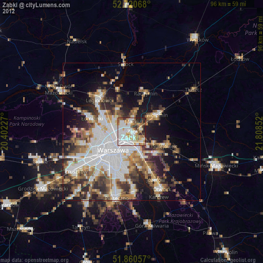
» Earth at Night: Flat Maps 2012, 2016