Grodków night lights from space
Night Light of Grodków (Opole Voivodeship) from space (Poland) Src. Average luminocity for 10x10km area is 5.0775% and for 50x50km: 2.4716%.
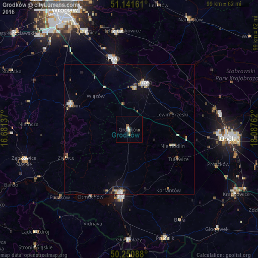
Analysis of Grodków night lights 2016
Square area 10x10 km:
 0.67%
0.67%90-99
0.67%80-89
0.8%70-79
0.53%60-69
0%50-59
1.2%40-49
1.07%30-39
1.34%20-29
0.67%10-19
0%0-9
93.05%Square area 50x50 km:
0.37%90-99
0.46%80-89
0.28%70-79
0.25%60-69
0.22%50-59
0.22%40-49
0.21%30-39
0.2%20-29
0.36%10-19
1.48%0-9
95.95%Clear (daylight) street map image can be seen on geolist.org.
Map coordinates:
51° 8' 29.8" North, 16° 40' 52.9" East
50° 41' 54.1" North, 17° 23' 4.2" East
50° 15' 3.2" North, 18° 5' 15.4" East
Some cities around Grodków sort by population:
• Nysa
25.2 km =15.7 mi,  188°
188°
• Brzeg
19 km =11.8 mi,  17°
17°
• Oława
28.3 km =17.6 mi,  346°
346°
• Strzelin
24.3 km =15.1 mi,  292°
292°
• Ziębice
26.5 km =16.5 mi,  245°
245°
• Niemodlin
17.7 km =11 mi,  110°
110°
• Lewin Brzeski
17.3 km =10.7 mi,  71°
71°
• Otmuchów
29.8 km =18.5 mi,  209°
209°
3098333 (p: 8,654)
Sources (retrieved 2019-11-25):
» Earth at Night: Flat Maps 2012, 2016