Otmuchów night lights from space
Night Light of Otmuchów (Opole Voivodeship) from space (Poland) Src. Average luminocity for 10x10km area is 1.7381% and for 50x50km: 1.9741%.
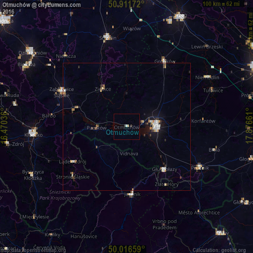
Analysis of Otmuchów night lights 2016
Square area 10x10 km:
 0.42%
0.42%90-99
0.14%80-89
0%70-79
0.56%60-69
0%50-59
0%40-49
0.14%30-39
0.98%20-29
0%10-19
0%0-9
97.76%Square area 50x50 km:
0.26%90-99
0.4%80-89
0.15%70-79
0.23%60-69
0.22%50-59
0.19%40-49
0.21%30-39
0.38%20-29
0.27%10-19
1.14%0-9
96.56%Clear (daylight) street map image can be seen on geolist.org.
Map coordinates:
50° 54' 42.2" North, 16° 28' 13.3" East
50° 27' 58.6" North, 17° 10' 24.5" East
50° 0' 59.7" North, 17° 52' 35.8" East
Some cities around Otmuchów sort by population:
• Nysa
11.4 km =7.1 mi,  85°
85°
• Ząbkowice Śląskie
29 km =18 mi,  298°
298°
• Głuchołazy
22.5 km =14 mi,  138°
138°
• Jeseník, CZ
26.4 km =16.4 mi,  175°
175°
• Ziębice
17.7 km =11 mi,  327°
327°
• Paczków
11.8 km =7.3 mi,  268°
268°
• Stronie Śląskie
28.5 km =17.7 mi,  228°
228°
• Lądek-Zdrój
24.9 km =15.5 mi,  236°
236°
3089642 (p: 5,181)
Sources (retrieved 2019-11-25):
» Earth at Night: Flat Maps 2012, 2016