Strzelin night lights from space
Night Light of Strzelin (Lower Silesia) from space (Poland) Src. Average luminocity for 10x10km area is 8.6289% and for 50x50km: 3.0261%.
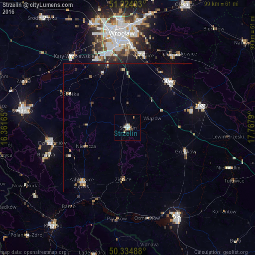
Analysis of Strzelin night lights 2016
Square area 10x10 km:
 1.68%
1.68%90-99
1.68%80-89
1.12%70-79
0.7%60-69
1.26%50-59
0.28%40-49
0.84%30-39
0.84%20-29
0.56%10-19
0.7%0-9
90.34%Square area 50x50 km:
0.41%90-99
0.49%80-89
0.25%70-79
0.26%60-69
0.31%50-59
0.4%40-49
0.36%30-39
0.29%20-29
0.29%10-19
2.05%0-9
94.89%Clear (daylight) street map image can be seen on geolist.org.
Map coordinates:
51° 13' 26.5" North, 16° 21' 41.9" East
50° 46' 53.7" North, 17° 3' 53.2" East
50° 20' 5.6" North, 17° 46' 4.4" East
Some cities around Strzelin sort by population:
• Brzeg
29.6 km =18.4 mi,  72°
72°
• Dzierżoniów
29.7 km =18.5 mi,  258°
258°
• Oława
24.3 km =15.1 mi,  41°
41°
• Ząbkowice Śląskie
27.8 km =17.3 mi,  219°
219°
• Ziębice
20.1 km =12.5 mi,  184°
184°
• Grodków
24.3 km =15.1 mi,  112°
112°
• Sobótka
26.1 km =16.2 mi,  300°
300°
• Piława Górna
25.1 km =15.6 mi,  244°
244°
3084404 (p: 12,394)
Sources (retrieved 2019-11-25):
» Earth at Night: Flat Maps 2012, 2016