Sanjwal night lights from space
Night Light of Sanjwal (Punjab) from space (Pakistan) Src. Average luminocity for 10x10km area is 11.7179% and for 50x50km: 7.2593%.
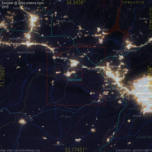
Analysis of Sanjwal night lights 2016
Square area 10x10 km:
 0%
0%90-99
2.75%80-89
0.92%70-79
2.93%60-69
0.37%50-59
2.56%40-49
0.18%30-39
0.55%20-29
1.47%10-19
15.93%0-9
72.34%Square area 50x50 km:
0.3%90-99
1.26%80-89
0.67%70-79
0.64%60-69
0.92%50-59
1.09%40-49
1.46%30-39
1.25%20-29
2.29%10-19
6.15%0-9
83.98%Clear (daylight) street map image can be seen on geolist.org.
Map coordinates:
34° 20' 37" North, 71° 43' 48.1" East
33° 45' 39.8" North, 72° 25' 59.3" East
33° 10' 28.2" North, 73° 8' 10.6" East
Some cities around Sanjwal sort by population:
• Swabi
40.1 km =24.9 mi,  4°
4°
• Nowshera Cantonment
48 km =29.8 mi,  303°
303°
• Attock City
6.8 km =4.2 mi,  275°
275°
• Risalpur Cantonment
52.5 km =32.6 mi,  309°
309°
• Topi
38.5 km =23.9 mi,  26°
26°
• Zaida
33.3 km =20.7 mi,  5°
5°
• Hazro City
17.4 km =10.8 mi,  18°
18°
• Akora
39.1 km =24.3 mi, 313°
1166118 (p: 10,657)
Sources (retrieved 2019-11-25):
» Earth at Night: Flat Maps 2012, 2016