Swabi night lights from space
Night Light of Swabi (Khyber Pakhtunkhwa) from space (Pakistan) Src. Average luminocity for 10x10km area is 8.5824% and for 50x50km: 4.3241%.
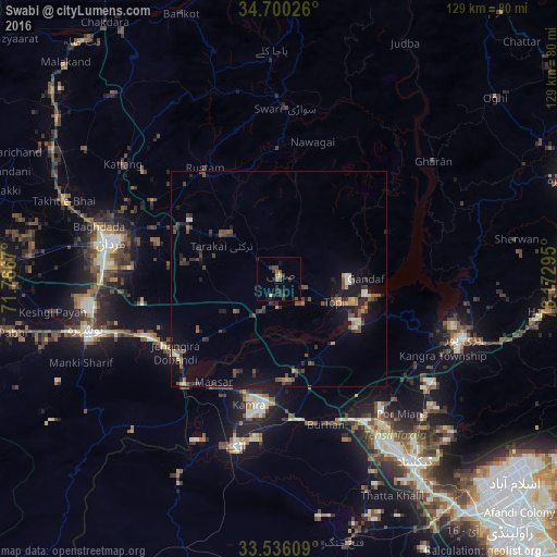
Analysis of Swabi night lights 2016
Square area 10x10 km:
 0%
0%90-99
0%80-89
0.55%70-79
0.92%60-69
1.47%50-59
1.47%40-49
2.93%30-39
3.66%20-29
4.76%10-19
2.2%0-9
82.05%Square area 50x50 km:
0.04%90-99
0.46%80-89
0.29%70-79
0.44%60-69
0.41%50-59
0.73%40-49
1.53%30-39
1.08%20-29
1.39%10-19
2.96%0-9
90.66%Clear (daylight) street map image can be seen on geolist.org.
Map coordinates:
34° 42' 0.9" North, 71° 46' 0.1" East
34° 7' 12.6" North, 72° 28' 11.4" East
33° 32' 9.9" North, 73° 10' 22.6" East
Some cities around Swabi sort by population:
• Mardan
39.6 km =24.6 mi,  282°
282°
• Attock City
40.6 km =25.2 mi,  194°
194°
• Khalabat
39.2 km =24.4 mi,  99°
99°
• Topi
15 km =9.3 mi,  111°
111°
• Zaida
6.8 km =4.2 mi,  182°
182°
• Hazro City
23.5 km =14.6 mi, 175°
• Akora
34.3 km =21.3 mi,  247°
247°
• Sanjwal
40.1 km =24.9 mi, 184°
1164216 (p: 97,363)
Sources (retrieved 2019-11-25):
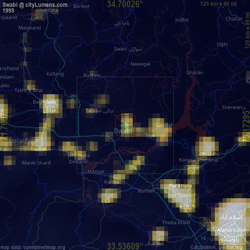
» NASA, Earths city lights 1995
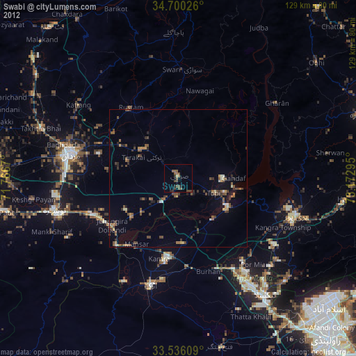
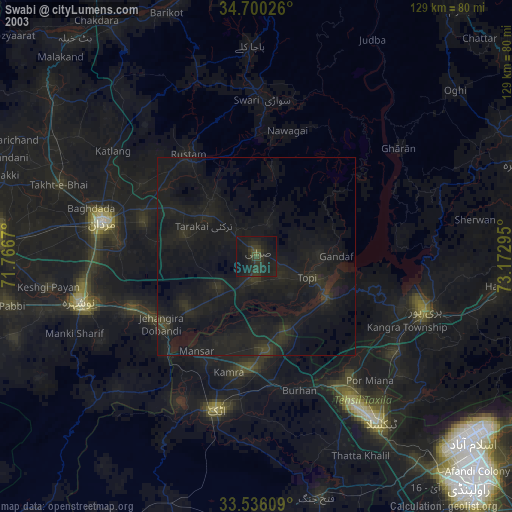
» NASA city lights 2003
» Earth at Night: Flat Maps 2012, 2016