Zaida night lights from space
Night Light of Zaida (Khyber Pakhtunkhwa) from space (Pakistan) Src. Average luminocity for 10x10km area is 6.7885% and for 50x50km: 6.5208%.
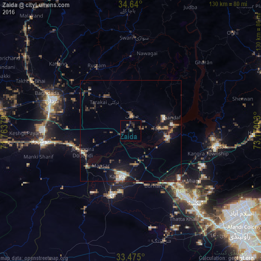

Analysis of Zaida night lights 2016
Square area 10x10 km:
 0%
0%90-99
0%80-89
0.52%70-79
0.52%60-69
0.35%50-59
0.52%40-49
2.27%30-39
3.67%20-29
6.82%10-19
1.22%0-9
84.09%Square area 50x50 km:
0.28%90-99
1.04%80-89
0.46%70-79
0.56%60-69
0.65%50-59
0.96%40-49
1.85%30-39
1.26%20-29
1.92%10-19
5.38%0-9
85.64%Clear (daylight) street map image can be seen on geolist.org.
Map coordinates:
34° 38' 24" North, 71° 45' 49.6" East
34° 3' 34.2" North, 72° 28' 0.8" East
33° 28' 30" North, 73° 10' 12.1" East
Some cities around Zaida sort by population:
• Mardan
41.4 km =25.7 mi,  291°
291°
• Swabi
6.8 km =4.2 mi,  2°
2°
• Attock City
34 km =21.1 mi,  196°
196°
• Khalabat
38.9 km =24.2 mi,  89°
89°
• Topi
14.3 km =8.9 mi, 85°
• Hazro City
16.8 km =10.4 mi,  172°
172°
• Akora
32.1 km =19.9 mi,  258°
258°
• Sanjwal
33.3 km =20.7 mi,  185°
185°
1162261 (p: 26,787)
Sources (retrieved 2019-11-25):
» Earth at Night: Flat Maps 2012, 2016