Nowshera Cantonment night lights from space
Night Light of Nowshera Cantonment (Khyber Pakhtunkhwa) from space (Pakistan) Src. Average luminocity for 10x10km area is 37.3182% and for 50x50km: 12.3717%.
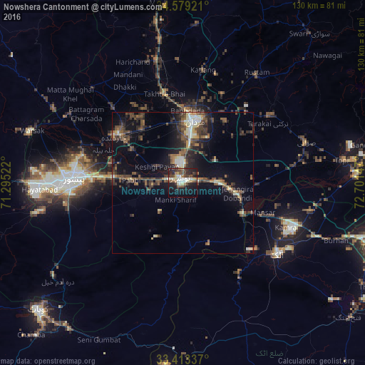
Analysis of Nowshera Cantonment night lights 2016
Square area 10x10 km:
 3.5%
3.5%90-99
8.57%80-89
6.12%70-79
1.4%60-69
3.15%50-59
6.47%40-49
7.34%30-39
7.34%20-29
13.81%10-19
27.8%0-9
14.51%Square area 50x50 km:
0.45%90-99
2.14%80-89
1.18%70-79
0.89%60-69
1.2%50-59
2.5%40-49
3.53%30-39
2.96%20-29
4.1%10-19
8.97%0-9
72.09%Clear (daylight) street map image can be seen on geolist.org.
Map coordinates:
34° 34' 45.2" North, 71° 17' 42.8" East
33° 59' 53.8" North, 71° 59' 54" East
33° 24' 48.1" North, 72° 42' 5.3" East
Some cities around Nowshera Cantonment sort by population:
• Peshawar
38.7 km =24 mi,  271°
271°
• Mardan
22.7 km =14.1 mi,  12°
12°
• Charsadda
29 km =18 mi,  305°
305°
• Pabbi
18.8 km =11.7 mi, 273°
• Risalpur Cantonment
6.9 km =4.3 mi,  355°
355°
• Utmanzai
30.2 km =18.8 mi, 314°
• Aman Garh
6.4 km =4 mi,  277°
277°
• Akora
11.7 km =7.3 mi,  87°
87°
1341204 (p: 96,766)
Sources (retrieved 2019-11-25):
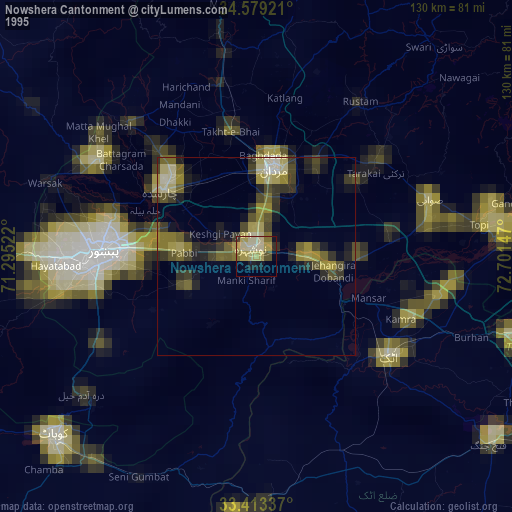
» NASA, Earths city lights 1995
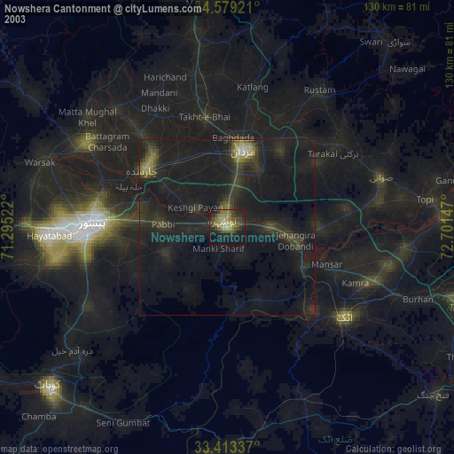
» NASA city lights 2003
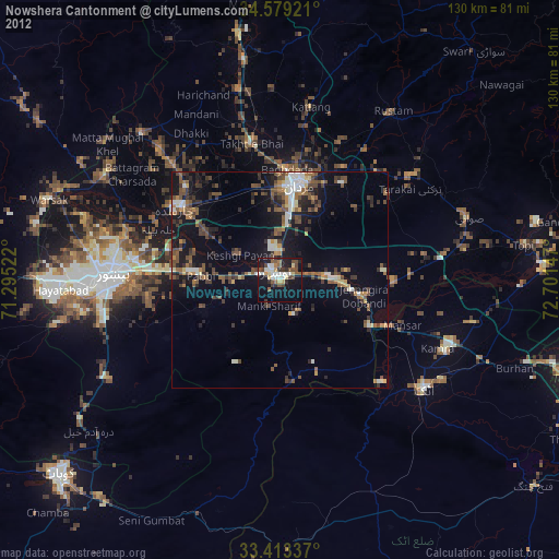
» Earth at Night: Flat Maps 2012, 2016