Bulaon night lights from space
Night Light of Bulaon (Central Luzon) from space (Philippines) Src. Average luminocity for 10x10km area is 52.8967% and for 50x50km: 17.5077%.
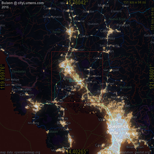
Analysis of Bulaon night lights 2016
Square area 10x10 km:
 4.13%
4.13%90-99
3.31%80-89
4.13%70-79
18.18%60-69
25.21%50-59
2.07%40-49
9.71%30-39
5.79%20-29
13.43%10-19
12.4%0-9
1.65%Square area 50x50 km:
0.84%90-99
1.12%80-89
1.36%70-79
4.65%60-69
4.55%50-59
1.93%40-49
3.89%30-39
3.58%20-29
5.8%10-19
11.62%0-9
60.67%Clear (daylight) street map image can be seen on geolist.org.
Map coordinates:
15° 45' 37.5" North, 119° 57' 35.1" East
15° 4' 57.4" North, 120° 39' 46.4" East
14° 24' 9.5" North, 121° 21' 57.6" East
Some cities around Bulaon sort by population:
• San Fernando
5.9 km =3.7 mi,  156°
156°
• Mexico
6.4 km =4 mi,  108°
108°
• Del Pilar
6.5 km =4 mi,  142°
142°
• Pandacaqui
10 km =6.2 mi,  354°
354°
• Telabastagan
7.1 km =4.4 mi,  304°
304°
• San Basilio
10.1 km =6.3 mi,  237°
237°
• Cauayan
7.7 km =4.8 mi,  7°
7°
• Calibutbut
7.8 km =4.8 mi, 297°
1722930 (p: 131,818)
Sources (retrieved 2019-11-25):
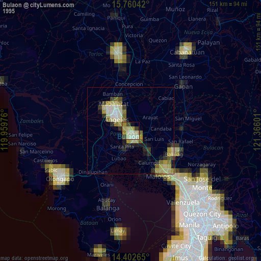
» NASA, Earths city lights 1995
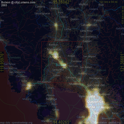
» NASA city lights 2003
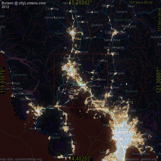
» Earth at Night: Flat Maps 2012, 2016