San Mariano night lights from space
Night Light of San Mariano (Central Luzon) from space (Philippines) Src. Average luminocity for 10x10km area is 8.961% and for 50x50km: 4.5795%.
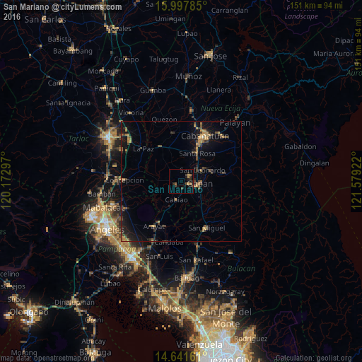
Analysis of San Mariano night lights 2016
Square area 10x10 km:
 0%
0%90-99
0%80-89
0.87%70-79
2.38%60-69
1.95%50-59
0%40-49
2.38%30-39
3.25%20-29
3.03%10-19
4.55%0-9
81.6%Square area 50x50 km:
0%90-99
0.03%80-89
0.31%70-79
1.07%60-69
0.93%50-59
0.5%40-49
1.07%30-39
1.01%20-29
1.47%10-19
4.24%0-9
89.37%Clear (daylight) street map image can be seen on geolist.org.
Map coordinates:
15° 59' 52.3" North, 120° 10' 22.7" East
15° 19' 15" North, 120° 52' 33.9" East
14° 38' 29.8" North, 121° 34' 45.2" East
Some cities around San Mariano sort by population:
• Gapan
7.7 km =4.8 mi,  101°
101°
• Jaen
4.7 km =2.9 mi,  80°
80°
• Papaya
4.3 km =2.7 mi,  269°
269°
• San Antonio
2.7 km =1.7 mi,  232°
232°
• San Francisco
5.5 km =3.4 mi,  315°
315°
• Santo Cristo
3.1 km =1.9 mi,  150°
150°
• Nieves
7.9 km =4.9 mi, 83°
• Entablado
4.1 km =2.5 mi,  200°
200°
1689084 (p: 5,686)
Sources (retrieved 2019-11-25):
» Earth at Night: Flat Maps 2012, 2016