Nieves night lights from space
Night Light of Nieves (Central Luzon) from space (Philippines) Src. Average luminocity for 10x10km area is 15.487% and for 50x50km: 3.1617%.
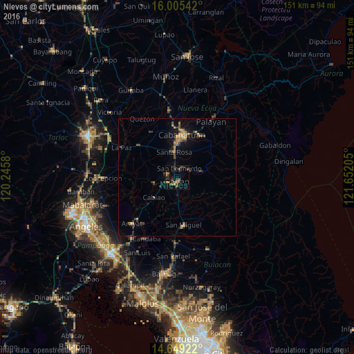
Analysis of Nieves night lights 2016
Square area 10x10 km:
 0%
0%90-99
0%80-89
0.87%70-79
4.11%60-69
3.46%50-59
1.52%40-49
6.71%30-39
3.46%20-29
5.19%10-19
6.06%0-9
68.61%Square area 50x50 km:
0%90-99
0.03%80-89
0.24%70-79
0.87%60-69
0.58%50-59
0.3%40-49
0.84%30-39
0.76%20-29
0.83%10-19
2.14%0-9
93.41%Clear (daylight) street map image can be seen on geolist.org.
Map coordinates:
16° 0' 19.5" North, 120° 14' 44.9" East
15° 19' 42.3" North, 120° 56' 56.1" East
14° 38' 57.2" North, 121° 39' 7.4" East
Some cities around Nieves sort by population:
• Gapan
2.4 km =1.5 mi,  186°
186°
• Jaen
3.2 km =2 mi,  268°
268°
• San Leonardo
4.2 km =2.6 mi,  22°
22°
• Peñaranda
6.4 km =4 mi,  66°
66°
• Pulo
9.4 km =5.8 mi, 193°
• Santo Cristo
7.2 km =4.5 mi,  240°
240°
• San Mariano
7.9 km =4.9 mi,  263°
263°
• Entablado
10.3 km =6.4 mi, 243°
1697696 (p: 8,617)
Sources (retrieved 2019-11-25):
» Earth at Night: Flat Maps 2012, 2016