Papaya night lights from space
Night Light of Papaya (Central Luzon) from space (Philippines) Src. Average luminocity for 10x10km area is 1.8326% and for 50x50km: 7.7409%.
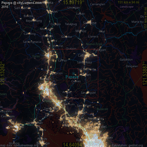
Analysis of Papaya night lights 2016
Square area 10x10 km:
 0%
0%90-99
0%80-89
0%70-79
0%60-69
0.83%50-59
0%40-49
0.41%30-39
1.03%20-29
0.62%10-19
0.83%0-9
96.28%Square area 50x50 km:
0.03%90-99
0.07%80-89
0.57%70-79
1.95%60-69
2.13%50-59
0.94%40-49
1.91%30-39
1.65%20-29
2.5%10-19
6.01%0-9
82.23%Clear (daylight) street map image can be seen on geolist.org.
Map coordinates:
15° 59' 49.9" North, 120° 7' 57.4" East
15° 19' 12.6" North, 120° 50' 8.7" East
14° 38' 27.4" North, 121° 32' 19.9" East
Some cities around Papaya sort by population:
• Cabiao
8.2 km =5.1 mi,  165°
165°
• Jaen
9 km =5.6 mi,  84°
84°
• San Antonio
2.7 km =1.7 mi,  125°
125°
• San Francisco
4 km =2.5 mi,  6°
6°
• Santo Cristo
6.4 km =4 mi,  113°
113°
• Santa Barbara
8.4 km =5.2 mi,  329°
329°
• San Mariano
4.3 km =2.7 mi,  89°
89°
• Entablado
4.7 km =2.9 mi,  141°
141°
1694826 (p: 38,640)
Sources (retrieved 2019-11-25):
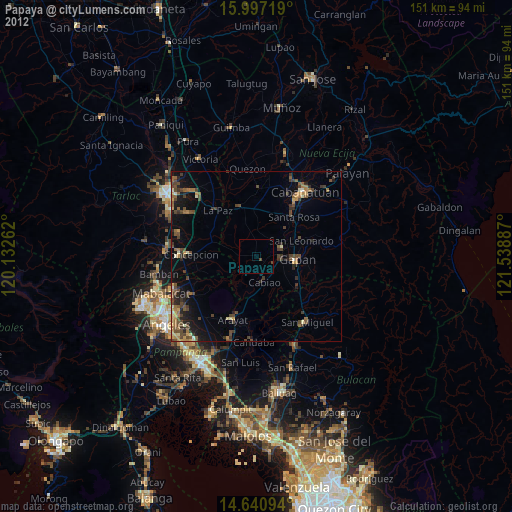
» Earth at Night: Flat Maps 2012, 2016