Quisao night lights from space
Night Light of Quisao (Calabarzon) from space (Philippines) Src. Average luminocity for 10x10km area is 2.1017% and for 50x50km: 12.907%.
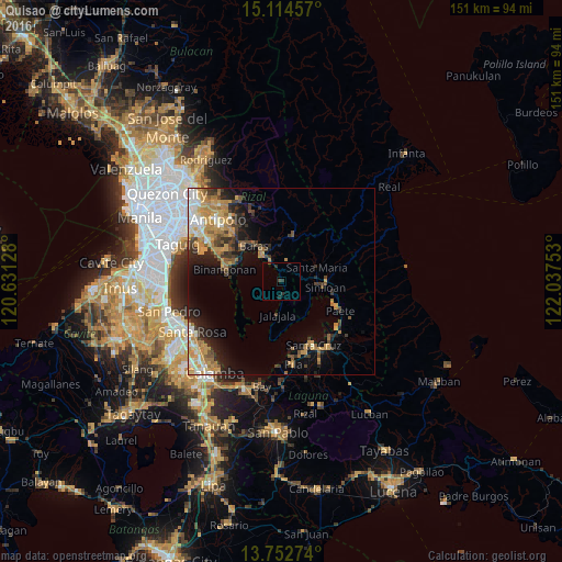
Analysis of Quisao night lights 2016
Square area 10x10 km:
 0%
0%90-99
0%80-89
0%70-79
0%60-69
0%50-59
0.22%40-49
0.65%30-39
2.16%20-29
1.73%10-19
0%0-9
95.24%Square area 50x50 km:
1.22%90-99
1.73%80-89
1.36%70-79
3.61%60-69
2.66%50-59
1.27%40-49
1.57%30-39
2.22%20-29
2.87%10-19
5.36%0-9
76.13%Clear (daylight) street map image can be seen on geolist.org.
Map coordinates:
15° 6' 52.5" North, 120° 37' 52.6" East
14° 26' 4.9" North, 121° 20' 3.8" East
13° 45' 9.9" North, 122° 2' 15.1" East
Some cities around Quisao sort by population:
• Tanay
8.7 km =5.4 mi,  322°
322°
• Pililla
6.4 km =4 mi,  331°
331°
• Baras
11.8 km =7.3 mi, 321°
• Sampaloc
12.1 km =7.5 mi,  13°
13°
• Jalajala
9.2 km =5.7 mi,  188°
188°
• Mabitac
10.2 km =6.3 mi,  95°
95°
• Malaya
4.2 km =2.6 mi,  173°
173°
• Santa Maria
11 km =6.8 mi,  67°
67°
1691973 (p: 10,989)
Sources (retrieved 2019-11-25):
» Earth at Night: Flat Maps 2012, 2016