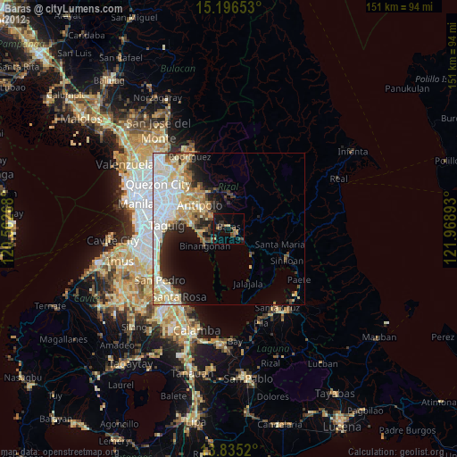
Baras night lights from space
Night Light of Baras (Calabarzon) from space (Philippines) Src. Average luminocity for 10x10km area is 19.961% and for 50x50km: 23.2993%.
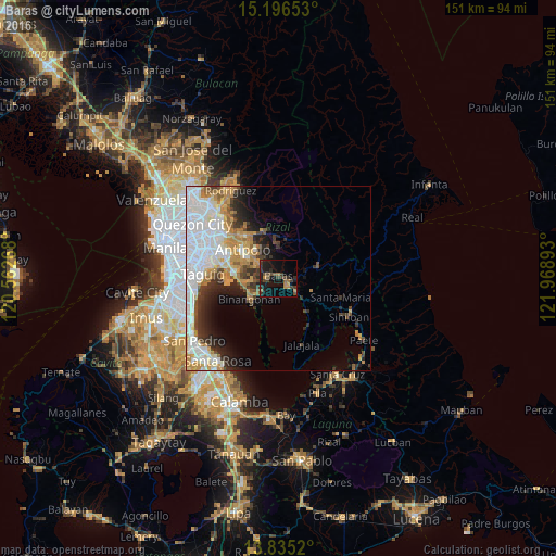
Analysis of Baras night lights 2016
Square area 10x10 km:
 0%
0%90-99
0%80-89
0.22%70-79
3.03%60-69
4.33%50-59
2.38%40-49
8.44%30-39
6.93%20-29
6.28%10-19
23.38%0-9
45.02%Square area 50x50 km:
7.27%90-99
4.87%80-89
1.85%70-79
3.84%60-69
2.91%50-59
1.38%40-49
1.87%30-39
3.13%20-29
3.87%10-19
5.44%0-9
63.58%Clear (daylight) street map image can be seen on geolist.org.
Map coordinates:
15° 11' 47.5" North, 120° 33' 45.6" East
14° 31' 0.9" North, 121° 15' 56.9" East
13° 50' 6.7" North, 121° 58' 8.1" East
Some cities around Baras sort by population:
• Binangonan
9.8 km =6.1 mi,  233°
233°
• Tanay
3 km =1.9 mi,  137°
137°
• Morong
3 km =1.9 mi,  273°
273°
• Teresa
7 km =4.3 mi,  314°
314°
• Pililla
5.6 km =3.5 mi,  128°
128°
• Cardona
5.3 km =3.3 mi, 230°
• Sampaloc
10.5 km =6.5 mi,  75°
75°
• Pinugay
8.9 km =5.5 mi,  357°
357°
1726765 (p: 20,250)
Sources (retrieved 2019-11-25):
» Earth at Night: Flat Maps 2012, 2016