Mabitac night lights from space
Night Light of Mabitac (Calabarzon) from space (Philippines) Src. Average luminocity for 10x10km area is 4.9567% and for 50x50km: 4.5748%.
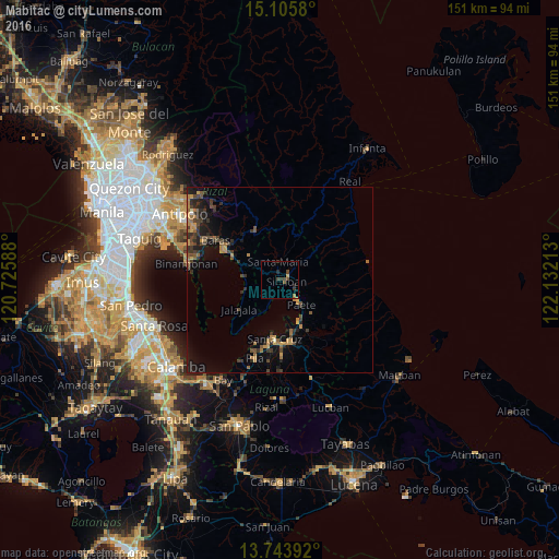
Analysis of Mabitac night lights 2016
Square area 10x10 km:
 0%
0%90-99
0%80-89
0%70-79
1.08%60-69
0.65%50-59
1.08%40-49
2.6%30-39
2.81%20-29
1.73%10-19
0%0-9
90.04%Square area 50x50 km:
0.02%90-99
0.05%80-89
0.16%70-79
1.06%60-69
1.06%50-59
0.68%40-49
1.05%30-39
1.64%20-29
1.28%10-19
3.2%0-9
89.82%Clear (daylight) street map image can be seen on geolist.org.
Map coordinates:
15° 6' 20.9" North, 120° 43' 33.2" East
14° 25' 33.2" North, 121° 25' 44.4" East
13° 44' 38.1" North, 122° 7' 55.7" East
Some cities around Mabitac sort by population:
• Lumbang
14.7 km =9.1 mi,  166°
166°
• Paete
8.9 km =5.5 mi,  139°
139°
• Pangil
4.6 km =2.9 mi,  122°
122°
• Jalajala
14 km =8.7 mi,  234°
234°
• Malaya
10.3 km =6.4 mi,  251°
251°
• Quisao
10.2 km =6.3 mi,  275°
275°
• Pakil
7.1 km =4.4 mi,  131°
131°
• Santa Maria
5.1 km =3.2 mi,  359°
359°
1704537 (p: 12,398)
Sources (retrieved 2019-11-25):
» Earth at Night: Flat Maps 2012, 2016