Tanay night lights from space
Night Light of Tanay (Calabarzon) from space (Philippines) Src. Average luminocity for 10x10km area is 14.0303% and for 50x50km: 19.5378%.
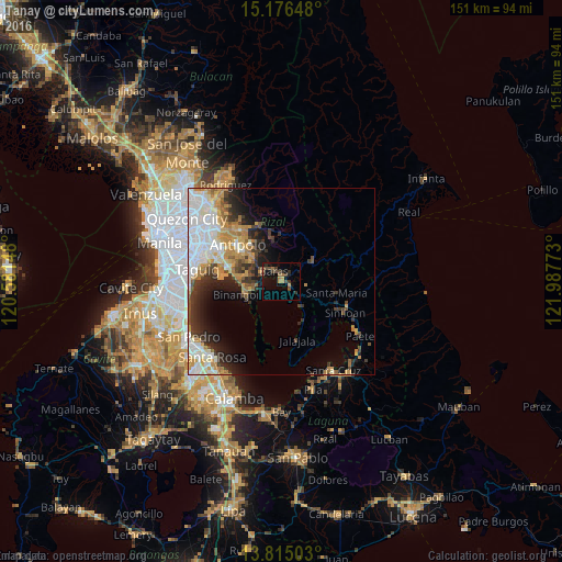
Analysis of Tanay night lights 2016
Square area 10x10 km:
 0%
0%90-99
0%80-89
0.22%70-79
2.38%60-69
3.68%50-59
1.52%40-49
5.63%30-39
4.33%20-29
2.81%10-19
9.96%0-9
69.48%Square area 50x50 km:
4.96%90-99
3.65%80-89
1.75%70-79
3.6%60-69
2.88%50-59
1.31%40-49
1.78%30-39
3.06%20-29
3.96%10-19
5.68%0-9
67.35%Clear (daylight) street map image can be seen on geolist.org.
Map coordinates:
15° 10' 35.3" North, 120° 34' 53.3" East
14° 29' 48.5" North, 121° 17' 4.6" East
13° 48' 54.1" North, 121° 59' 15.8" East
Some cities around Tanay sort by population:
• Binangonan
10.5 km =6.5 mi,  250°
250°
• Morong
5.6 km =3.5 mi,  295°
295°
• Teresa
10 km =6.2 mi,  315°
315°
• Pililla
2.6 km =1.6 mi,  118°
118°
• Cardona
6.3 km =3.9 mi,  259°
259°
• Baras
3 km =1.9 mi, 317°
• Sampaloc
9.5 km =5.9 mi,  59°
59°
• Quisao
8.7 km =5.4 mi,  142°
142°
1683319 (p: 59,950)
Sources (retrieved 2019-11-25):
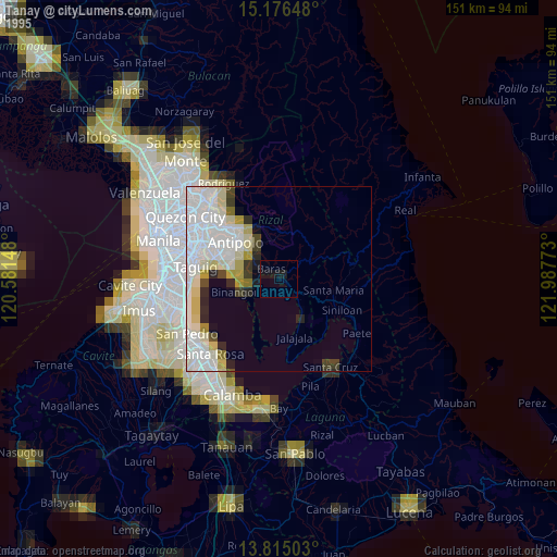
» NASA, Earths city lights 1995
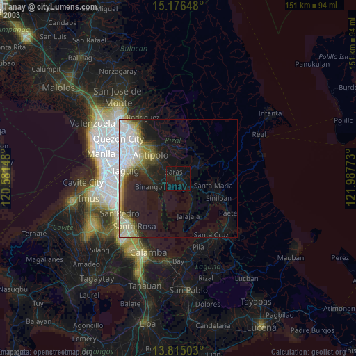
» NASA city lights 2003
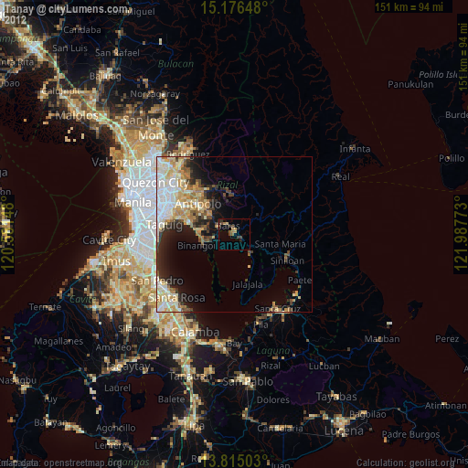
» Earth at Night: Flat Maps 2012, 2016