Payocpoc Sur night lights from space
Night Light of Payocpoc Sur (Ilocos) from space (Philippines) Src. Average luminocity for 10x10km area is 3.5248% and for 50x50km: 1.8944%.
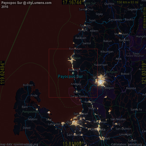
Analysis of Payocpoc Sur night lights 2016
Square area 10x10 km:
 0%
0%90-99
0%80-89
0%70-79
0.83%60-69
0.83%50-59
0.41%40-49
1.86%30-39
0.83%20-29
1.24%10-19
0.62%0-9
93.39%Square area 50x50 km:
0.02%90-99
0.05%80-89
0.17%70-79
0.41%60-69
0.32%50-59
0.26%40-49
0.34%30-39
0.36%20-29
0.67%10-19
1.51%0-9
95.89%Clear (daylight) street map image can be seen on geolist.org.
Map coordinates:
17° 10' 2.8" North, 119° 37' 29.8" East
16° 29' 40" North, 120° 19' 41" East
15° 49' 8.7" North, 121° 1' 52.3" East
Some cities around Payocpoc Sur sort by population:
• Baguio
29.6 km =18.4 mi,  107°
107°
• San Fernando
13.6 km =8.5 mi,  354°
354°
• La Trinidad
28 km =17.4 mi,  99°
99°
• Aringay
11.5 km =7.1 mi,  165°
165°
• Bauang
4.1 km =2.5 mi,  7°
7°
• Subusub
34.7 km =21.6 mi,  149°
149°
• Paringao
8.6 km =5.3 mi,  357°
357°
• Lloren
21.1 km =13.1 mi, 148°
1694167 (p: 13,107)
Sources (retrieved 2019-11-25):
» Earth at Night: Flat Maps 2012, 2016