Subusub night lights from space
Night Light of Subusub (Ilocos) from space (Philippines) Src. Average luminocity for 10x10km area is 3.7583% and for 50x50km: 6.7983%.
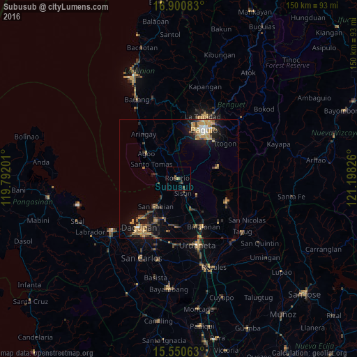
Analysis of Subusub night lights 2016
Square area 10x10 km:
 0%
0%90-99
0%80-89
0%70-79
0.83%60-69
0%50-59
1.65%40-49
1.24%30-39
2.07%20-29
2.48%10-19
0%0-9
91.74%Square area 50x50 km:
0.39%90-99
0.4%80-89
0.9%70-79
1.83%60-69
1.1%50-59
0.69%40-49
1.35%30-39
1.17%20-29
1.61%10-19
4.89%0-9
85.69%Clear (daylight) street map image can be seen on geolist.org.
Map coordinates:
16° 54' 3" North, 119° 47' 31.2" East
16° 13' 36.8" North, 120° 29' 42.5" East
15° 33' 2.3" North, 121° 11' 53.7" East
Some cities around Subusub sort by population:
• Mangaldan
20.1 km =12.5 mi,  209°
209°
• Manaoag
20.4 km =12.7 mi,  182°
182°
• Nibaliw Central
14.8 km =9.2 mi,  221°
221°
• San Jacinto
18.2 km =11.3 mi,  199°
199°
• Sison
6.3 km =3.9 mi,  159°
159°
• Binalonan
22.2 km =13.8 mi,  152°
152°
• Nilombot
22.7 km =14.1 mi, 195°
• Lloren
13.5 km =8.4 mi,  330°
330°
1685556 (p: 6,887)
Sources (retrieved 2019-11-25):
» Earth at Night: Flat Maps 2012, 2016