Baguio night lights from space
Night Light of Baguio (Cordillera) from space (Philippines) Src. Average luminocity for 10x10km area is 64.4256% and for 50x50km: 4.0601%.
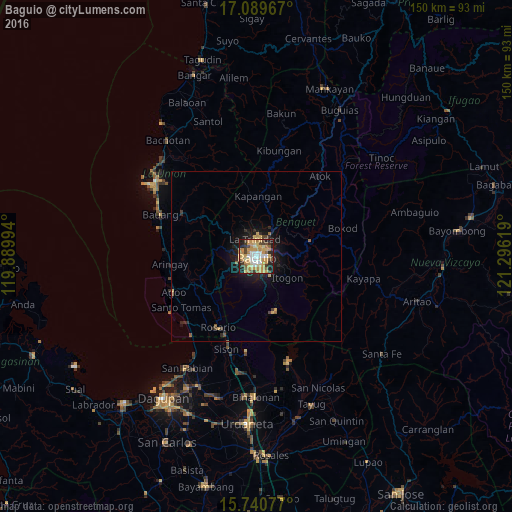
Analysis of Baguio night lights 2016
Square area 10x10 km:
 8.68%
8.68%90-99
9.3%80-89
13.43%70-79
26.86%60-69
6.61%50-59
4.13%40-49
8.88%30-39
6.2%20-29
9.09%10-19
6.82%0-9
0%Square area 50x50 km:
0.35%90-99
0.37%80-89
0.67%70-79
1.29%60-69
0.34%50-59
0.3%40-49
0.59%30-39
0.4%20-29
1.09%10-19
3.19%0-9
91.42%Clear (daylight) street map image can be seen on geolist.org.
Map coordinates:
17° 5' 22.8" North, 119° 53' 23.8" East
16° 24' 59" North, 120° 35' 35" East
15° 44' 26.8" North, 121° 17' 46.3" East
Some cities around Baguio sort by population:
• La Trinidad
4.3 km =2.7 mi,  352°
352°
• Aringay
25.6 km =15.9 mi,  264°
264°
• Itogon
10.7 km =6.6 mi,  123°
123°
• Sison
28.2 km =17.5 mi,  197°
197°
• Tuding
5.3 km =3.3 mi,  96°
96°
• Subusub
23.5 km =14.6 mi,  206°
206°
• Loacan
16.8 km =10.4 mi,  27°
27°
• Lloren
19.4 km =12.1 mi,  241°
241°
1728930 (p: 272,714)
Sources (retrieved 2019-11-25):
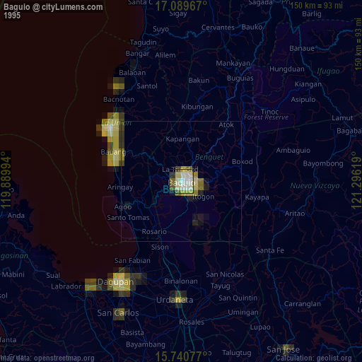
» NASA, Earths city lights 1995
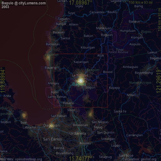
» NASA city lights 2003
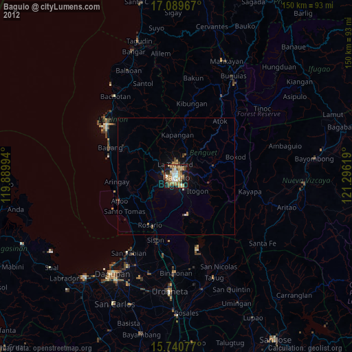
» Earth at Night: Flat Maps 2012, 2016