Bauang night lights from space
Night Light of Bauang (Ilocos) from space (Philippines) Src. Average luminocity for 10x10km area is 7.2355% and for 50x50km: 2.0283%.
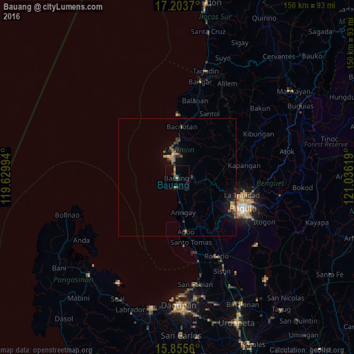
Analysis of Bauang night lights 2016
Square area 10x10 km:
 0%
0%90-99
0%80-89
0.62%70-79
1.03%60-69
1.65%50-59
2.07%40-49
1.86%30-39
0.83%20-29
2.69%10-19
0.41%0-9
88.84%Square area 50x50 km:
0.02%90-99
0.06%80-89
0.19%70-79
0.45%60-69
0.31%50-59
0.31%40-49
0.42%30-39
0.39%20-29
0.69%10-19
1.58%0-9
95.59%Clear (daylight) street map image can be seen on geolist.org.
Map coordinates:
17° 12' 13.3" North, 119° 37' 47.8" East
16° 31' 51" North, 120° 19' 59" East
15° 51' 20.2" North, 121° 2' 10.3" East
Some cities around Bauang sort by population:
• Baguio
30.5 km =19 mi,  114°
114°
• San Fernando
9.6 km =6 mi,  349°
349°
• La Trinidad
28.4 km =17.6 mi, 107°
• Aringay
15.4 km =9.6 mi,  171°
171°
• Payocpoc Sur
4.1 km =2.5 mi,  187°
187°
• Paringao
4.6 km =2.9 mi, 348°
• Loacan
35.6 km =22.1 mi,  86°
86°
• Lloren
24.4 km =15.2 mi,  154°
154°
1725983 (p: 17,109)
Sources (retrieved 2019-11-25):
» Earth at Night: Flat Maps 2012, 2016