Maao night lights from space
Night Light of Maao (Western Visayas) from space (Philippines) Src. Average luminocity for 10x10km area is 0.4897% and for 50x50km: 4.7877%.
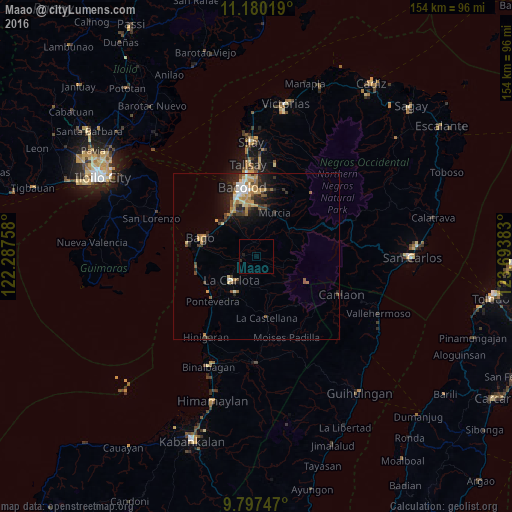
Analysis of Maao night lights 2016
Square area 10x10 km:
 0%
0%90-99
0%80-89
0%70-79
0%60-69
0%50-59
0%40-49
0%30-39
0%20-29
1.24%10-19
0.41%0-9
98.35%Square area 50x50 km:
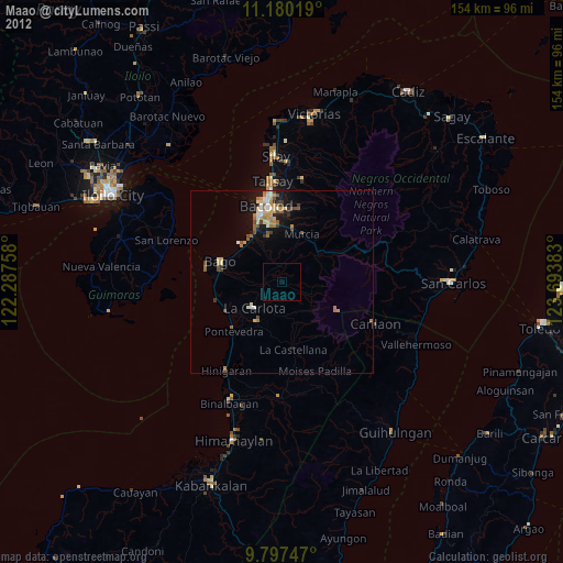
0.37%90-99
0.54%80-89
0.83%70-79
0.83%60-69
0.75%50-59
0.49%40-49
0.77%30-39
0.86%20-29
1.55%10-19
2.69%0-9
90.31%Clear (daylight) street map image can be seen on geolist.org.
Map coordinates:
11° 10' 48.7" North, 122° 17' 15.3" East
10° 29' 22.6" North, 122° 59' 26.5" East
9° 47' 50.9" North, 123° 41' 37.8" East
Some cities around Maao sort by population:
• La Carlota
10.5 km =6.5 mi,  226°
226°
• Taloc
14.1 km =8.8 mi,  312°
312°
• Murcia
14 km =8.7 mi,  23°
23°
• Minuyan
12.8 km =8 mi,  77°
77°
• Dulao
8.2 km =5.1 mi,  315°
315°
• Busay
12.6 km =7.8 mi,  295°
295°
• Napoles
10.3 km =6.4 mi,  278°
278°
• La Granja
9.1 km =5.7 mi,  180°
180°
1704781 (p: 25,837)
Sources (retrieved 2019-11-25):
» Earth at Night: Flat Maps 2012, 2016