Mangaldan night lights from space
Night Light of Mangaldan (Ilocos) from space (Philippines) Src. Average luminocity for 10x10km area is 20.1054% and for 50x50km: 5.5339%.
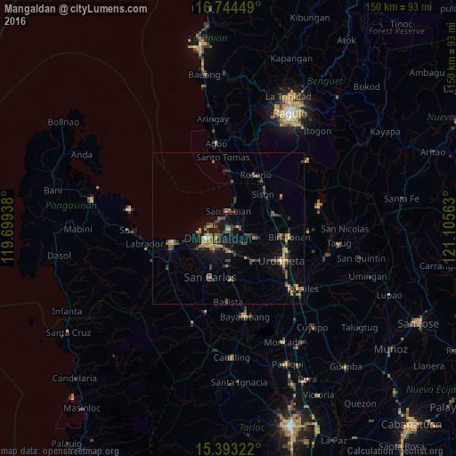

Analysis of Mangaldan night lights 2016
Square area 10x10 km:
 0%
0%90-99
0%80-89
1.03%70-79
3.72%60-69
1.86%50-59
2.89%40-49
8.68%30-39
7.44%20-29
4.96%10-19
28.31%0-9
41.12%Square area 50x50 km:
0.07%90-99
0.06%80-89
0.45%70-79
1.22%60-69
1.07%50-59
0.74%40-49
1.56%30-39
1.58%20-29
1.22%10-19
3.47%0-9
88.57%Clear (daylight) street map image can be seen on geolist.org.
Map coordinates:
16° 44' 40.2" North, 119° 41' 57.8" East
16° 4' 12" North, 120° 24' 9" East
15° 23' 35.6" North, 121° 6' 20.3" East
Some cities around Mangaldan sort by population:
• Dagupan
8 km =5 mi,  248°
248°
• Manaoag
9.4 km =5.8 mi,  108°
108°
• Calasiao
8 km =5 mi,  214°
214°
• Santa Barbara
7.7 km =4.8 mi,  180°
180°
• Nibaliw Central
6.4 km =4 mi,  0°
0°
• Mapandan
7.5 km =4.7 mi,  132°
132°
• San Jacinto
3.8 km =2.4 mi,  85°
85°
• Nilombot
5.7 km =3.5 mi,  140°
140°
1701872 (p: 88,818)
Sources (retrieved 2019-11-25):
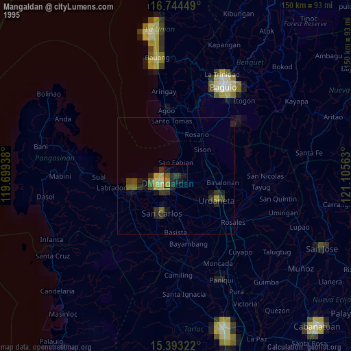
» NASA, Earths city lights 1995
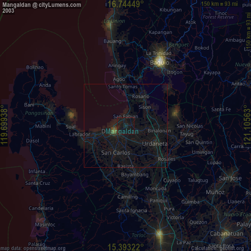
» NASA city lights 2003
» Earth at Night: Flat Maps 2012, 2016