Santa Barbara night lights from space
Night Light of Santa Barbara (Ilocos) from space (Philippines) Src. Average luminocity for 10x10km area is 17.0764% and for 50x50km: 5.7399%.
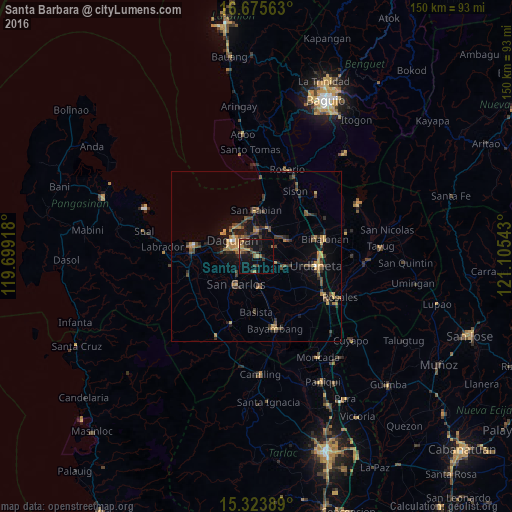
Analysis of Santa Barbara night lights 2016
Square area 10x10 km:
 0%
0%90-99
0%80-89
0.62%70-79
3.93%60-69
3.72%50-59
2.48%40-49
3.31%30-39
4.96%20-29
3.93%10-19
23.55%0-9
53.51%Square area 50x50 km:
0.07%90-99
0.06%80-89
0.5%70-79
1.25%60-69
1.14%50-59
0.71%40-49
1.69%30-39
1.59%20-29
1.26%10-19
3.56%0-9
88.17%Clear (daylight) street map image can be seen on geolist.org.
Map coordinates:
16° 40' 32.3" North, 119° 41' 57" East
16° 0' 3.2" North, 120° 24' 8.3" East
15° 19' 26" North, 121° 6' 19.5" East
Some cities around Santa Barbara sort by population:
• Dagupan
8.7 km =5.4 mi,  302°
302°
• Mangaldan
7.7 km =4.8 mi,  0°
0°
• Calasiao
4.7 km =2.9 mi,  284°
284°
• Mapandan
6.2 km =3.9 mi,  64°
64°
• Bulog
4.5 km =2.8 mi,  180°
180°
• Nilombot
5 km =3.1 mi,  48°
48°
• Nagsaing
7.2 km =4.5 mi,  251°
251°
• Loqueb Este
7.8 km =4.8 mi,  143°
143°
1688372 (p: 15,445)
Sources (retrieved 2019-11-25):
» Earth at Night: Flat Maps 2012, 2016