Lumbang night lights from space
Night Light of Lumbang (Calabarzon) from space (Philippines) Src. Average luminocity for 10x10km area is 16.1277% and for 50x50km: 4.2986%.
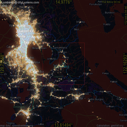
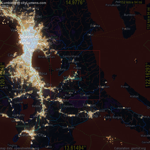
Analysis of Lumbang night lights 2016
Square area 10x10 km:
 0%
0%90-99
0.22%80-89
1.3%70-79
6.49%60-69
2.81%50-59
2.81%40-49
2.6%30-39
1.95%20-29
2.38%10-19
9.74%0-9
69.7%Square area 50x50 km:
0.03%90-99
0.03%80-89
0.19%70-79
1.04%60-69
0.95%50-59
0.68%40-49
0.94%30-39
1.19%20-29
0.78%10-19
2.8%0-9
91.36%Clear (daylight) street map image can be seen on geolist.org.
Map coordinates:
14° 58' 39.4" North, 120° 45' 24" East
14° 17' 50.3" North, 121° 27' 35.3" East
13° 36' 53.8" North, 122° 9' 46.5" East
Some cities around Lumbang sort by population:
• Santa Cruz
5 km =3.1 mi,  249°
249°
• Pila
12.5 km =7.8 mi,  234°
234°
• Paete
7.9 km =4.9 mi,  18°
18°
• Pangil
11.8 km =7.3 mi,  2°
2°
• Pakil
9.8 km =6.1 mi,  11°
11°
• Cavinti
7.8 km =4.8 mi,  138°
138°
• Kalayaan
12.9 km =8 mi,  63°
63°
• Maulawin
4.4 km =2.7 mi,  219°
219°
1705190 (p: 30,269)
Sources (retrieved 2019-11-25):
» Earth at Night: Flat Maps 2012, 2016