Kalayaan night lights from space
Night Light of Kalayaan (Calabarzon) from space (Philippines) Src. Average luminocity for 10x10km area is 0.1753% and for 50x50km: 2.3917%.
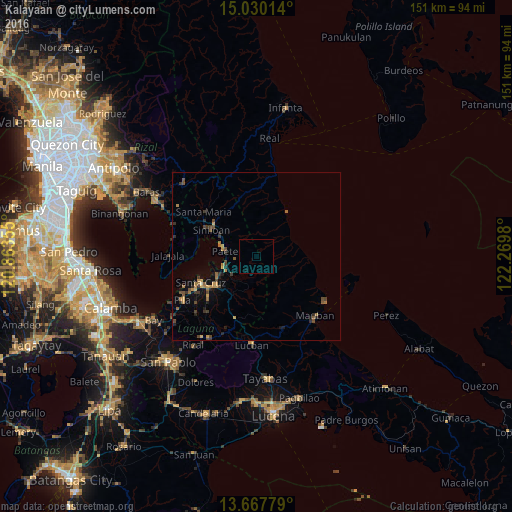
Analysis of Kalayaan night lights 2016
Square area 10x10 km:
 0%
0%90-99
0%80-89
0%70-79
0%60-69
0%50-59
0%40-49
0%30-39
0%20-29
0%10-19
0.43%0-9
99.57%Square area 50x50 km:
0%90-99
0.03%80-89
0.09%70-79
0.66%60-69
0.53%50-59
0.41%40-49
0.61%30-39
0.61%20-29
0.53%10-19
0.96%0-9
95.58%Clear (daylight) street map image can be seen on geolist.org.
Map coordinates:
15° 1' 48.5" North, 120° 51' 48.8" East
14° 21' 0" North, 121° 34' 0" East
13° 40' 4" North, 122° 16' 11.3" East
Some cities around Kalayaan sort by population:
• Santa Cruz
17.9 km =11.1 mi,  244°
244°
• Lumbang
12.9 km =8 mi, 243°
• Paete
9.2 km =5.7 mi,  280°
280°
• Pangil
12.4 km =7.7 mi,  298°
298°
• Mabitac
17.1 km =10.6 mi, 299°
• Pakil
10.2 km =6.3 mi,  291°
291°
• Cavinti
13.3 km =8.3 mi,  208°
208°
• Maulawin
17.1 km =10.6 mi, 237°
1709650 (p: 7,306)
Sources (retrieved 2019-11-25):
» Earth at Night: Flat Maps 2012, 2016