Cavinti night lights from space
Night Light of Cavinti (Calabarzon) from space (Philippines) Src. Average luminocity for 10x10km area is 1.4502% and for 50x50km: 4.0468%.
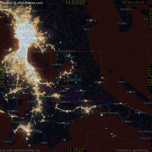
Analysis of Cavinti night lights 2016
Square area 10x10 km:
 0%
0%90-99
0%80-89
0%70-79
0%60-69
0%50-59
0%40-49
0.87%30-39
0%20-29
0%10-19
0%0-9
99.13%Square area 50x50 km:
0.01%90-99
0.06%80-89
0.26%70-79
1.02%60-69
0.9%50-59
0.62%40-49
0.88%30-39
1.13%20-29
0.88%10-19
2.17%0-9
92.09%Clear (daylight) street map image can be seen on geolist.org.
Map coordinates:
14° 55' 31" North, 120° 48' 17.5" East
14° 14' 41.4" North, 121° 30' 28.7" East
13° 33' 44.3" North, 122° 12' 40" East
Some cities around Cavinti sort by population:
• Santa Cruz
10.7 km =6.6 mi,  292°
292°
• Lucban
15.5 km =9.6 mi,  160°
160°
• Lumbang
7.8 km =4.8 mi,  318°
318°
• Paete
13.6 km =8.5 mi,  348°
348°
• Lilio
14.8 km =9.2 mi,  211°
211°
• Majayjay
11.6 km =7.2 mi,  199°
199°
• Kalayaan
13.3 km =8.3 mi,  28°
28°
• Maulawin
8.4 km =5.2 mi, 286°
1717649 (p: 9,758)
Sources (retrieved 2019-11-25):
» Earth at Night: Flat Maps 2012, 2016