Los Baños night lights from space
Night Light of Los Baños (Calabarzon) from space (Philippines) Src. Average luminocity for 10x10km area is 26.4134% and for 50x50km: 22.2381%.
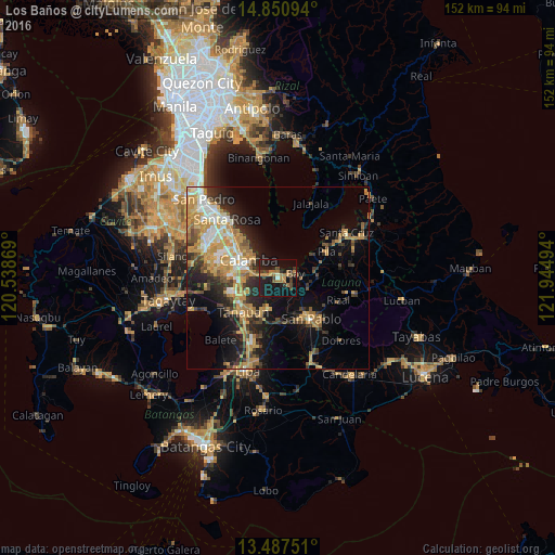
Analysis of Los Baños night lights 2016
Square area 10x10 km:
 0.65%
0.65%90-99
0.22%80-89
0.87%70-79
3.68%60-69
11.04%50-59
3.46%40-49
4.33%30-39
7.79%20-29
5.84%10-19
41.13%0-9
21%Square area 50x50 km:
1.97%90-99
2.95%80-89
2.37%70-79
6.82%60-69
3.91%50-59
2.13%40-49
2.82%30-39
3.5%20-29
5.55%10-19
10.97%0-9
57.02%Clear (daylight) street map image can be seen on geolist.org.
Map coordinates:
14° 51' 3.4" North, 120° 32' 19.3" East
14° 10' 12.9" North, 121° 14' 30.5" East
13° 29' 15" North, 121° 56' 41.8" East
Some cities around Los Baños sort by population:
• Calamba
9.4 km =5.8 mi,  299°
299°
• Mamatid
11.5 km =7.1 mi,  308°
308°
• Calauan
8.2 km =5.1 mi,  105°
105°
• Bay
4.9 km =3 mi,  72°
72°
• Victoria
11.4 km =7.1 mi,  55°
55°
• Masaya
4.8 km =3 mi,  115°
115°
• Bitin
6.4 km =4 mi,  199°
199°
• Dayap
9.9 km =6.2 mi,  83°
83°
1705536 (p: 95,750)
Sources (retrieved 2019-11-25):
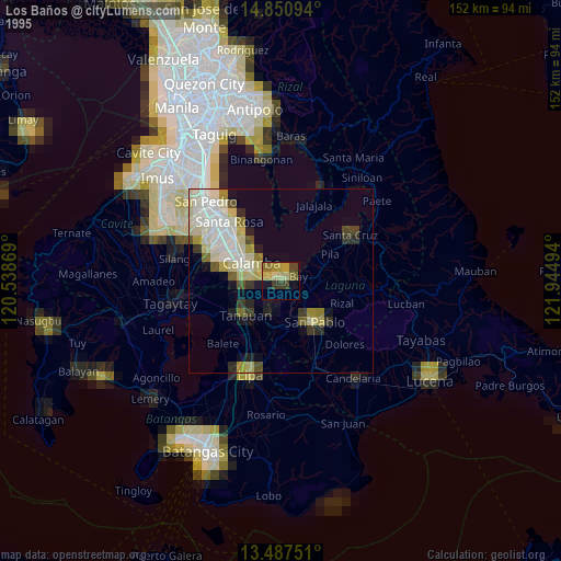
» NASA, Earths city lights 1995
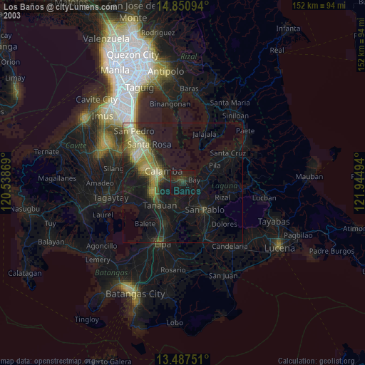
» NASA city lights 2003
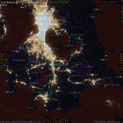
» Earth at Night: Flat Maps 2012, 2016