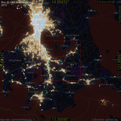
Bay night lights from space
Night Light of Bay (Calabarzon) from space (Philippines) Src. Average luminocity for 10x10km area is 17.5996% and for 50x50km: 18.582%.
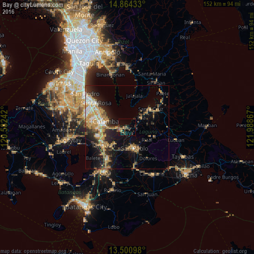
Analysis of Bay night lights 2016
Square area 10x10 km:
100  0.43%
0.43%
90-99 0%
80-89 0.43%
70-79 2.81%
60-69 5.41%
50-59 3.68%
40-49 4.55%
30-39 6.49%
20-29 3.25%
10-19 10.39%
0-9 62.55%
0.43%90-99
0%80-89
0.43%70-79
2.81%60-69
5.41%50-59
3.68%40-49
4.55%30-39
6.49%20-29
3.25%10-19
10.39%0-9
62.55%Square area 50x50 km:
100 1.65%
90-99 2.36%
80-89 1.86%
70-79 5.22%
60-69 3.3%
50-59 1.69%
40-49 2.33%
30-39 3.25%
20-29 5.28%
10-19 9.82%
0-9 63.23%
1.65%90-99
2.36%80-89
1.86%70-79
5.22%60-69
3.3%50-59
1.69%40-49
2.33%30-39
3.25%20-29
5.28%10-19
9.82%0-9
63.23%Clear (daylight) street map image can be seen on geolist.org.
Map coordinates:
14° 51' 51.6" North, 120° 34' 56.7" East
14° 11' 1.2" North, 121° 17' 7.9" East
13° 30' 3.5" North, 121° 59' 19.2" East
Some cities around Bay sort by population:
• Calamba
13.3 km =8.3 mi,  283°
283°
• Los Baños
4.9 km =3 mi,  252°
252°
• Calauan
4.9 km =3 mi,  139°
139°
• Pila
10.1 km =6.3 mi,  57°
57°
• Victoria
6.8 km =4.2 mi,  43°
43°
• Masaya
3.6 km =2.2 mi,  186°
186°
• Bitin
10.1 km =6.3 mi,  222°
222°
• Dayap
5.2 km =3.2 mi,  94°
94°
1725919 (p: 33,547)
Sources (retrieved 2019-11-25):
» Earth at Night: Flat Maps 2012, 2016