Bitin night lights from space
Night Light of Bitin (Calabarzon) from space (Philippines) Src. Average luminocity for 10x10km area is 20.5433% and for 50x50km: 22.6341%.
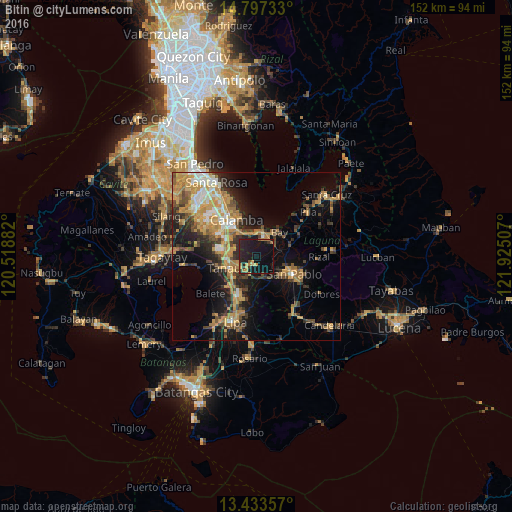
Analysis of Bitin night lights 2016
Square area 10x10 km:
 0%
0%90-99
0%80-89
2.16%70-79
4.55%60-69
3.68%50-59
1.73%40-49
0%30-39
3.46%20-29
13.64%10-19
38.96%0-9
31.82%Square area 50x50 km:
1.65%90-99
2.44%80-89
2.38%70-79
6.99%60-69
4.34%50-59
2.42%40-49
3.39%30-39
3.69%20-29
5.57%10-19
12.42%0-9
54.71%Clear (daylight) street map image can be seen on geolist.org.
Map coordinates:
14° 47' 50.4" North, 120° 31' 7.8" East
14° 6' 59.3" North, 121° 13' 19" East
13° 26' 0.9" North, 121° 55' 30.3" East
Some cities around Bitin sort by population:
• Los Baños
6.4 km =4 mi,  19°
19°
• Tanauan
8.5 km =5.3 mi,  246°
246°
• Santo Tomas
8.7 km =5.4 mi,  263°
263°
• Bay
10.1 km =6.3 mi,  42°
42°
• Alaminos
6.4 km =4 mi,  155°
155°
• Malvar
10.5 km =6.5 mi,  220°
220°
• Masaya
7.6 km =4.7 mi,  58°
58°
• San Andres
7.4 km =4.6 mi,  184°
184°
1724691 (p: 5,758)
Sources (retrieved 2019-11-25):
» Earth at Night: Flat Maps 2012, 2016