Dayap night lights from space
Night Light of Dayap (Calabarzon) from space (Philippines) Src. Average luminocity for 10x10km area is 7.7662% and for 50x50km: 14.6324%.
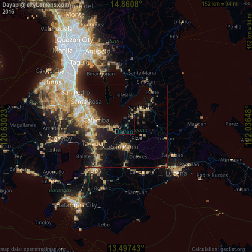
Analysis of Dayap night lights 2016
Square area 10x10 km:
 0%
0%90-99
0%80-89
0%70-79
0.43%60-69
0.43%50-59
2.38%40-49
2.6%30-39
3.03%20-29
2.38%10-19
2.6%0-9
86.15%Square area 50x50 km:
0.75%90-99
1.34%80-89
1.29%70-79
4.35%60-69
3%50-59
1.57%40-49
2.08%30-39
2.72%20-29
4.34%10-19
8.99%0-9
69.58%Clear (daylight) street map image can be seen on geolist.org.
Map coordinates:
14° 51' 38.9" North, 120° 37' 48.8" East
14° 10' 48.5" North, 121° 20' 0.1" East
13° 29' 50.7" North, 122° 2' 11.3" East
Some cities around Dayap sort by population:
• Los Baños
9.9 km =6.2 mi,  263°
263°
• Calauan
3.9 km =2.4 mi,  210°
210°
• Pila
6.7 km =4.2 mi,  30°
30°
• Bay
5.2 km =3.2 mi,  274°
274°
• Nagcarlan
10.2 km =6.3 mi,  118°
118°
• Victoria
5.3 km =3.3 mi,  355°
355°
• Lilio
12.3 km =7.6 mi, 116°
• Masaya
6.4 km =4 mi,  240°
240°
1715307 (p: 5,092)
Sources (retrieved 2019-11-25):
» Earth at Night: Flat Maps 2012, 2016