Liloan night lights from space
Night Light of Liloan (Central Visayas) from space (Philippines) Src. Average luminocity for 10x10km area is 37.0021% and for 50x50km: 13.1446%.
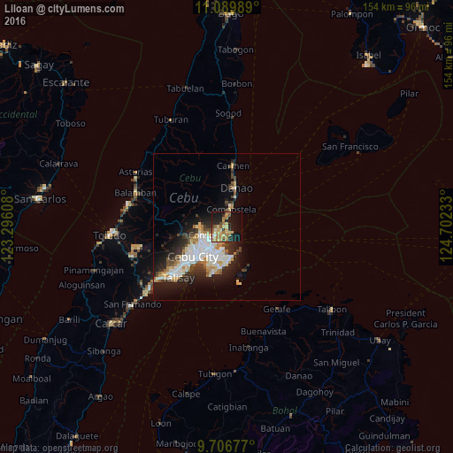
Analysis of Liloan night lights 2016
Square area 10x10 km:
 1.24%
1.24%90-99
2.07%80-89
11.16%70-79
6.4%60-69
11.98%50-59
3.51%40-49
2.48%30-39
2.07%20-29
11.16%10-19
31.61%0-9
16.32%Square area 50x50 km:
2.76%90-99
2.72%80-89
1.55%70-79
1.42%60-69
1.75%50-59
0.84%40-49
1.53%30-39
1.62%20-29
3.77%10-19
7.22%0-9
74.81%Clear (daylight) street map image can be seen on geolist.org.
Map coordinates:
11° 5' 23.6" North, 123° 17' 45.9" East
10° 23' 56.8" North, 123° 59' 57.1" East
9° 42' 24.4" North, 124° 42' 8.4" East
Some cities around Liloan sort by population:
• Cebu City
15 km =9.3 mi,  232°
232°
• Lapu-Lapu City
11.3 km =7 mi,  208°
208°
• Mandaue City
11.9 km =7.4 mi, 225°
• Danao
13.9 km =8.6 mi,  12°
12°
• Consolacion
5.2 km =3.2 mi,  241°
241°
• Apas
12.4 km =7.7 mi, 238°
• Compostela
6.3 km =3.9 mi, 11°
• Tayud
2.2 km =1.4 mi,  162°
162°
1706393 (p: 49,198)
Sources (retrieved 2019-11-25):
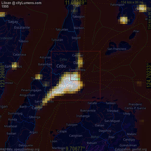
» NASA, Earths city lights 1995
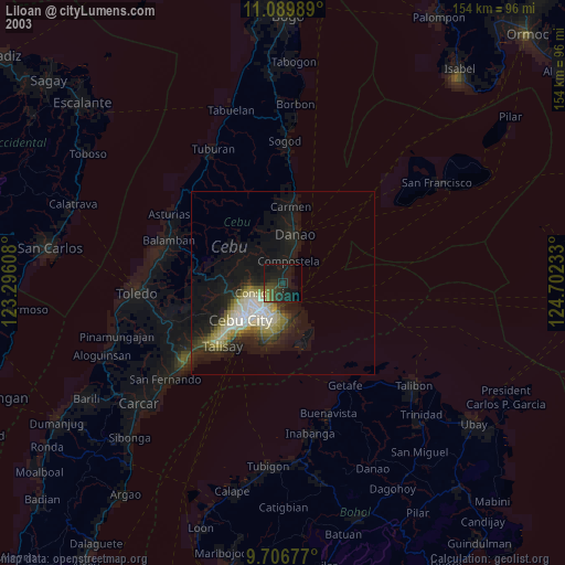
» NASA city lights 2003
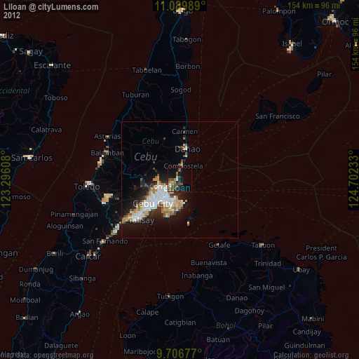
» Earth at Night: Flat Maps 2012, 2016