Danao night lights from space
Night Light of Danao (Central Visayas) from space (Philippines) Src. Average luminocity for 10x10km area is 11.3264% and for 50x50km: 8.4328%.
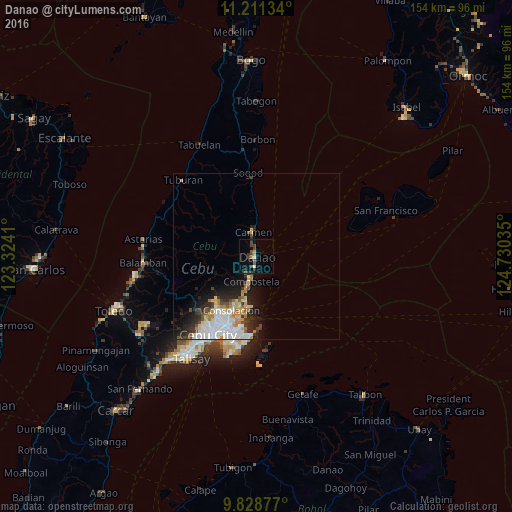
Analysis of Danao night lights 2016
Square area 10x10 km:
 0.83%
0.83%90-99
0.83%80-89
0.41%70-79
1.24%60-69
0.83%50-59
2.48%40-49
5.58%30-39
2.27%20-29
1.24%10-19
1.45%0-9
82.85%Square area 50x50 km:
2.03%90-99
1.78%80-89
1%70-79
0.74%60-69
1.14%50-59
0.47%40-49
1.12%30-39
0.98%20-29
2.15%10-19
3.66%0-9
84.93%Clear (daylight) street map image can be seen on geolist.org.
Map coordinates:
11° 12' 40.8" North, 123° 19' 26.8" East
10° 31' 15" North, 124° 1' 38" East
9° 49' 43.6" North, 124° 43' 49.3" East
Some cities around Danao sort by population:
• Liloan
13.9 km =8.6 mi,  192°
192°
• Consolacion
17.8 km =11.1 mi,  205°
205°
• Apas
24.2 km =15 mi, 214°
• Cogan
8.1 km =5 mi,  352°
352°
• Compostela
7.5 km =4.7 mi, 193°
• Catmon
22 km =13.7 mi, 352°
• Tayud
15.9 km =9.9 mi, 188°
• Nangka
7.4 km =4.6 mi,  296°
296°
1715804 (p: 70,270)
Sources (retrieved 2019-11-25):
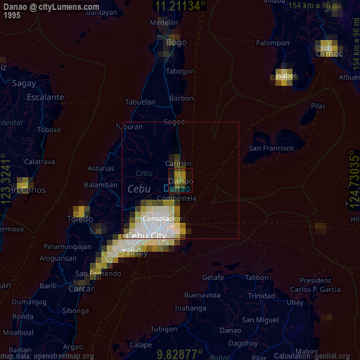
» NASA, Earths city lights 1995
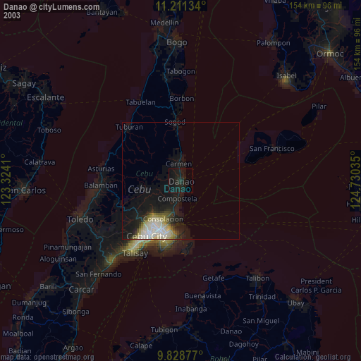
» NASA city lights 2003
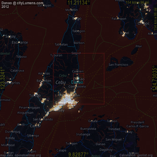
» Earth at Night: Flat Maps 2012, 2016