Las Piñas night lights from space
Night Light of Las Piñas (Metro Manila) from space (Philippines) Src. Average luminocity for 10x10km area is 89.0476% and for 50x50km: 45.0381%.
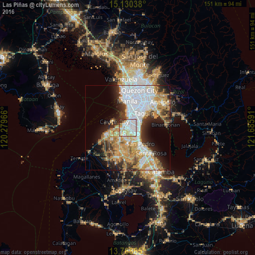
Analysis of Las Piñas night lights 2016
Square area 10x10 km:
 35.28%
90-99
32.9%80-89
14.5%70-79
6.49%60-69
1.73%50-59
1.73%40-49
2.38%30-39
4.55%20-29
0.43%10-19
0%0-9
0%Square area 50x50 km:
14.12%90-99
8.34%80-89
4.4%70-79
9.3%60-69
6.76%50-59
2.63%40-49
3.45%30-39
4.62%20-29
6.62%10-19
8.01%0-9
31.75%Clear (daylight) street map image can be seen on geolist.org.
Map coordinates:
15° 7' 49.4" North, 120° 16' 46.8" East
14° 27' 2" North, 120° 58' 58" East
13° 46' 7.1" North, 121° 41' 9.3" East
Some cities around Las Piñas sort by population:
• Makati City
12.3 km =7.6 mi,  25°
25°
• Pasay
9.9 km =6.2 mi,  11°
11°
• Bacoor
4.9 km =3 mi,  281°
281°
• San Pedro
12.3 km =7.6 mi,  145°
145°
• Imus
5.5 km =3.4 mi,  244°
244°
• Cavite City
9.8 km =6.1 mi,  292°
292°
• Kawit
8.8 km =5.5 mi,  265°
265°
• Noveleta
11.3 km =7 mi,  257°
257°
1707174 (p: 590,000)
Sources (retrieved 2019-11-25):
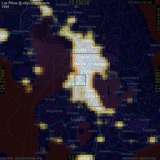
» NASA, Earths city lights 1995
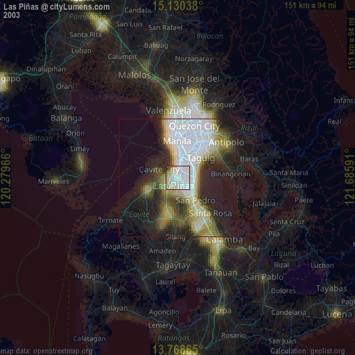
» NASA city lights 2003
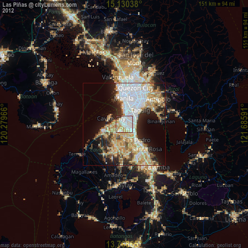
» Earth at Night: Flat Maps 2012, 2016