Bacoor night lights from space
Night Light of Bacoor (Calabarzon) from space (Philippines) Src. Average luminocity for 10x10km area is 65.7879% and for 50x50km: 42.6191%.
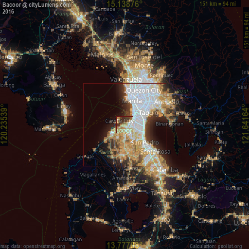
Analysis of Bacoor night lights 2016
Square area 10x10 km:
 8.01%
8.01%90-99
14.94%80-89
16.02%70-79
12.99%60-69
14.07%50-59
3.03%40-49
4.33%30-39
11.26%20-29
13.85%10-19
1.3%0-9
0.22%Square area 50x50 km:
14.26%90-99
8.37%80-89
4.07%70-79
8.41%60-69
5.79%50-59
2.31%40-49
2.97%30-39
4.05%20-29
5.82%10-19
6.68%0-9
37.26%Clear (daylight) street map image can be seen on geolist.org.
Map coordinates:
15° 8' 19.5" North, 120° 14' 7.4" East
14° 27' 32.3" North, 120° 56' 18.6" East
13° 46' 37.5" North, 121° 38' 29.9" East
Some cities around Bacoor sort by population:
• Las Piñas
4.9 km =3 mi,  101°
101°
• Pasay
11.1 km =6.9 mi,  37°
37°
• Imus
3.3 km =2.1 mi,  183°
183°
• Cavite City
5.1 km =3.2 mi,  302°
302°
• General Trias
10.1 km =6.3 mi,  217°
217°
• Kawit
4.3 km =2.7 mi,  247°
247°
• Port Area
14.2 km =8.8 mi,  12°
12°
• Noveleta
7.1 km =4.4 mi,  242°
242°
1729524 (p: 356,974)
Sources (retrieved 2019-11-25):
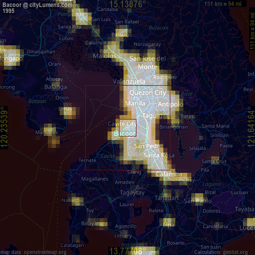
» NASA, Earths city lights 1995
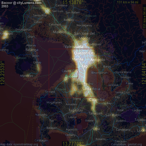
» NASA city lights 2003
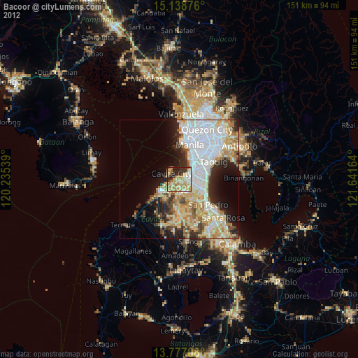
» Earth at Night: Flat Maps 2012, 2016