San Pedro night lights from space
Night Light of San Pedro (Calabarzon) from space (Philippines) Src. Average luminocity for 10x10km area is 74.1385% and for 50x50km: 41.588%.
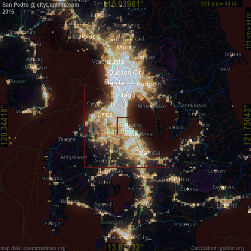
Analysis of San Pedro night lights 2016
Square area 10x10 km:
 16.02%
90-99
22.94%80-89
11.47%70-79
21.86%60-69
4.33%50-59
0.87%40-49
1.73%30-39
9.31%20-29
8.87%10-19
2.6%0-9
0%Square area 50x50 km:
8.44%90-99
7.23%80-89
4.61%70-79
10.02%60-69
7.16%50-59
3.4%40-49
4.6%30-39
5.57%20-29
7.96%10-19
12.29%0-9
28.71%Clear (daylight) street map image can be seen on geolist.org.
Map coordinates:
15° 2' 22.6" North, 120° 20' 39" East
14° 21' 34.2" North, 121° 2' 50.3" East
13° 40' 38.4" North, 121° 45' 1.5" East
Some cities around San Pedro sort by population:
• Las Piñas
12.3 km =7.6 mi,  325°
325°
• Dasmariñas
12.4 km =7.7 mi,  254°
254°
• Biñan
4.1 km =2.5 mi,  117°
117°
• Santa Rosa
8.7 km =5.4 mi,  127°
127°
• Pulong Santa Cruz
10.1 km =6.3 mi,  161°
161°
• Carmona
5.3 km =3.3 mi,  167°
167°
• Bulihan
10.7 km =6.6 mi,  211°
211°
• Maguyam
11.7 km =7.3 mi,  202°
202°
1688749 (p: 270,216)
Sources (retrieved 2019-11-25):
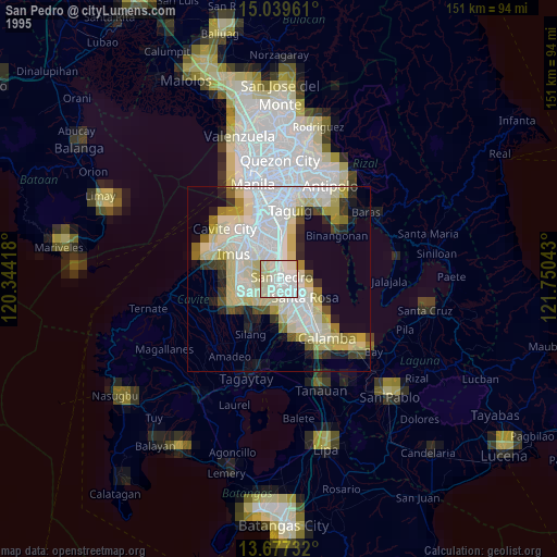
» NASA, Earths city lights 1995
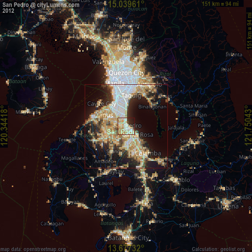
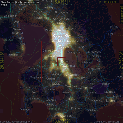
» NASA city lights 2003
» Earth at Night: Flat Maps 2012, 2016