Imus night lights from space
Night Light of Imus (Calabarzon) from space (Philippines) Src. Average luminocity for 10x10km area is 78.3788% and for 50x50km: 41.7256%.
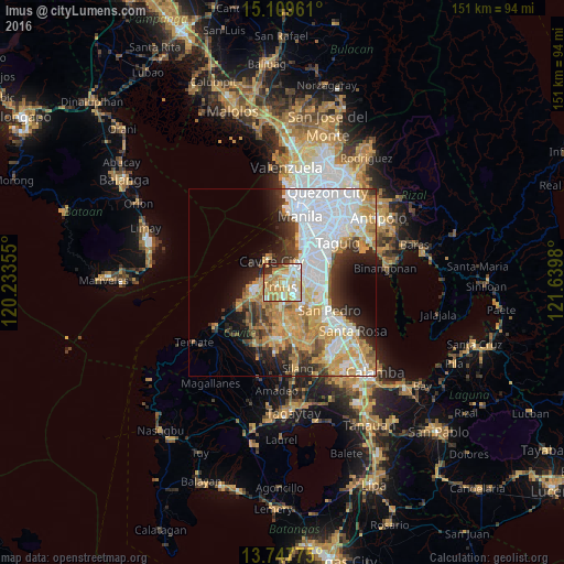
Analysis of Imus night lights 2016
Square area 10x10 km:
 11.04%
90-99
22.94%80-89
18.4%70-79
20.56%60-69
16.67%50-59
2.16%40-49
0.87%30-39
3.46%20-29
3.9%10-19
0%0-9
0%Square area 50x50 km:
12.98%90-99
7.93%80-89
4.31%70-79
8.85%60-69
5.92%50-59
2.3%40-49
3.12%30-39
4.16%20-29
6.01%10-19
6.99%0-9
37.42%Clear (daylight) street map image can be seen on geolist.org.
Map coordinates:
15° 6' 34.6" North, 120° 14' 0.8" East
14° 25' 47" North, 120° 56' 12" East
13° 44' 51.9" North, 121° 38' 23.3" East
Some cities around Imus sort by population:
• Las Piñas
5.5 km =3.4 mi,  64°
64°
• Dasmariñas
11.2 km =7 mi,  180°
180°
• Bacoor
3.3 km =2.1 mi,  3°
3°
• Cavite City
7.3 km =4.5 mi,  325°
325°
• General Trias
7.6 km =4.7 mi,  231°
231°
• Kawit
4.1 km =2.5 mi,  293°
293°
• Noveleta
6.1 km =3.8 mi,  269°
269°
• Pasong Kawayan Primero
11.3 km =7 mi,  211°
211°
1710914 (p: 216,099)
Sources (retrieved 2019-11-25):
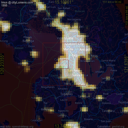
» NASA, Earths city lights 1995
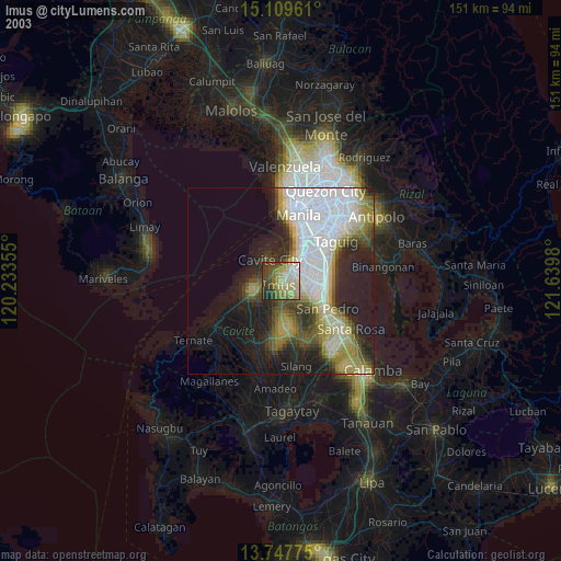
» NASA city lights 2003
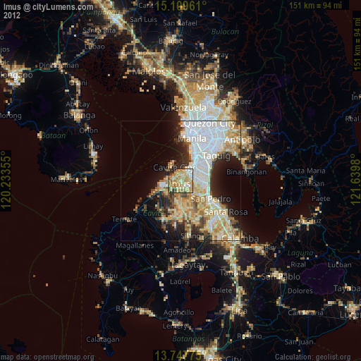
» Earth at Night: Flat Maps 2012, 2016