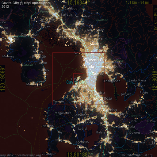
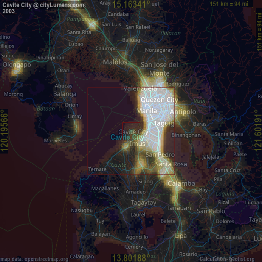
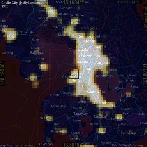
Cavite City night lights from space
Night Light of Cavite City (Calabarzon) from space (Philippines) Src. Average luminocity for 10x10km area is 29.6732% and for 50x50km: 40.049%.
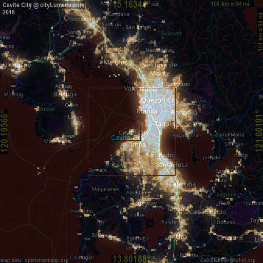
Analysis of Cavite City night lights 2016
Square area 10x10 km:
 0.65%
0.65%90-99
1.3%80-89
6.28%70-79
2.6%60-69
8.66%50-59
2.16%40-49
1.73%30-39
8.23%20-29
25.11%10-19
18.83%0-9
24.46%Square area 50x50 km:
14.64%90-99
8.87%80-89
3.68%70-79
6.58%60-69
4.81%50-59
1.7%40-49
2.61%30-39
3.65%20-29
4.81%10-19
5.5%0-9
43.15%Clear (daylight) street map image can be seen on geolist.org.
Map coordinates:
15° 9' 48.3" North, 120° 11' 44.4" East
14° 29' 1.3" North, 120° 53' 55.6" East
13° 48' 6.8" North, 121° 36' 6.9" East
Some cities around Cavite City sort by population:
• Las Piñas
9.8 km =6.1 mi,  112°
112°
• Pasay
12.6 km =7.8 mi,  61°
61°
• Bacoor
5.1 km =3.2 mi,  122°
122°
• Imus
7.3 km =4.5 mi,  145°
145°
• General Trias
10.9 km =6.8 mi,  189°
189°
• Kawit
4.4 km =2.7 mi,  175°
175°
• Port Area
13.3 km =8.3 mi,  33°
33°
• Noveleta
6.4 km =4 mi,  198°
198°
1717641 (p: 115,932)
Sources (retrieved 2019-11-25):
» NASA, Earths city lights 1995
» NASA city lights 2003
» Earth at Night: Flat Maps 2012, 2016