Kawit night lights from space
Night Light of Kawit (Calabarzon) from space (Philippines) Src. Average luminocity for 10x10km area is 57.5866% and for 50x50km: 39.5311%.
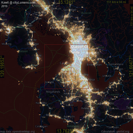
Analysis of Kawit night lights 2016
Square area 10x10 km:
 3.9%
3.9%90-99
7.79%80-89
11.69%70-79
21%60-69
16.45%50-59
1.95%40-49
1.95%30-39
7.14%20-29
17.97%10-19
8.66%0-9
1.52%Square area 50x50 km:
13.8%90-99
7.82%80-89
3.7%70-79
7.44%60-69
4.96%50-59
1.91%40-49
2.95%30-39
3.92%20-29
5.29%10-19
6.02%0-9
42.16%Clear (daylight) street map image can be seen on geolist.org.
Map coordinates:
15° 7' 26.8" North, 120° 11' 54.7" East
14° 26' 39.3" North, 120° 54' 5.9" East
13° 45' 44.4" North, 121° 36' 17.2" East
Some cities around Kawit sort by population:
• Las Piñas
8.8 km =5.5 mi,  85°
85°
• Bacoor
4.3 km =2.7 mi,  67°
67°
• Imus
4.1 km =2.5 mi,  113°
113°
• Cavite City
4.4 km =2.7 mi,  355°
355°
• General Trias
6.7 km =4.2 mi,  198°
198°
• Noveleta
2.9 km =1.8 mi,  234°
234°
• Halayhay
12.3 km =7.6 mi, 230°
• Pasong Kawayan Primero
11.4 km =7.1 mi,  190°
190°
1709003 (p: 73,210)
Sources (retrieved 2019-11-25):
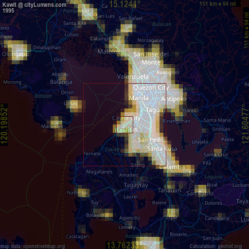
» NASA, Earths city lights 1995
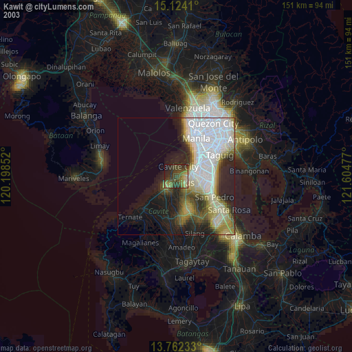
» NASA city lights 2003
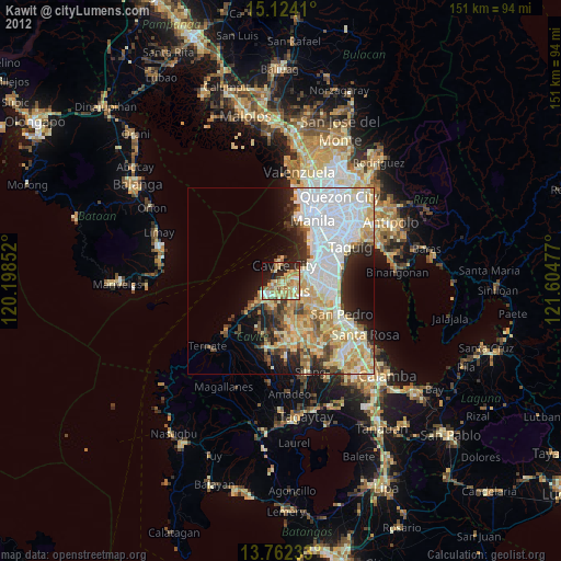
» Earth at Night: Flat Maps 2012, 2016