General Trias night lights from space
Night Light of General Trias (Calabarzon) from space (Philippines) Src. Average luminocity for 10x10km area is 62.5433% and for 50x50km: 34.3792%.
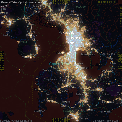
Analysis of General Trias night lights 2016
Square area 10x10 km:
 4.11%
4.11%90-99
7.14%80-89
6.71%70-79
21.43%60-69
24.68%50-59
9.31%40-49
10.61%30-39
8.23%20-29
5.63%10-19
2.16%0-9
0%Square area 50x50 km:
9.34%90-99
6.38%80-89
3.61%70-79
7.66%60-69
5.04%50-59
2.24%40-49
3.39%30-39
4.01%20-29
5.42%10-19
6.78%0-9
46.14%Clear (daylight) street map image can be seen on geolist.org.
Map coordinates:
15° 4' 1.1" North, 120° 10' 42.8" East
14° 23' 13" North, 120° 52' 54" East
13° 42' 17.4" North, 121° 35' 5.3" East
Some cities around General Trias sort by population:
• Dasmariñas
8.7 km =5.4 mi,  137°
137°
• Bacoor
10.1 km =6.3 mi,  37°
37°
• Imus
7.6 km =4.7 mi,  51°
51°
• Kawit
6.7 km =4.2 mi,  18°
18°
• Noveleta
4.7 km =2.9 mi,  357°
357°
• Halayhay
7.5 km =4.7 mi,  258°
258°
• Paradahan
7.7 km =4.8 mi,  197°
197°
• Pasong Kawayan Primero
4.9 km =3 mi,  180°
180°
1713014 (p: 96,022)
Sources (retrieved 2019-11-25):
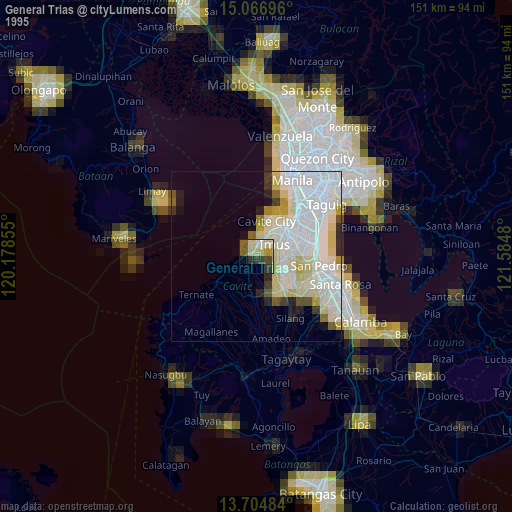
» NASA, Earths city lights 1995
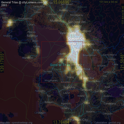
» NASA city lights 2003
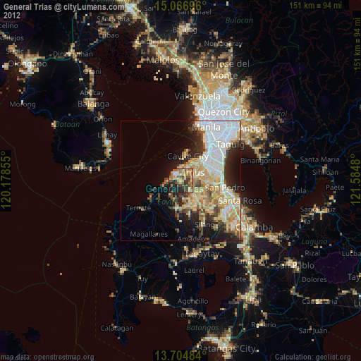
» Earth at Night: Flat Maps 2012, 2016